What do crustal carbonates have to do with CO2 emissions?
The proliferation of reefs and carbonate platforms in shallow-water environments contribute to accumulation of organic-C-rich carbonate rocks along the edge of continents. These platforms are a persistent phenomenon throughout the Phanerozoic and strongly suggests that large volumes of carbonates are buried in the upper crust within the continents.
Decarbonation reactions in crustal rocks occur during volcanism. Decarbonation is the process by which large amounts of carbon stored in carbonate crust are liberated in the form of CO2 due to the interaction of mantle melt. This results in large volumes of CO2 degassing along volcanic arcs, however these volumes are yet to be quantified in deep-time using a plate reconstruction framework.
We reconstructed the spatio-temporal distribution of carbonate platforms over the past 410 million years using the Phanerozoic carbonate platform patterns described by Kiessling and colleagues (2003). After reconstruction, we quantified the lengths of subduction zones that have interacted with carbonate platforms since 410 Ma.

How do you translate the distribution of carbonate platforms into an evolving model?
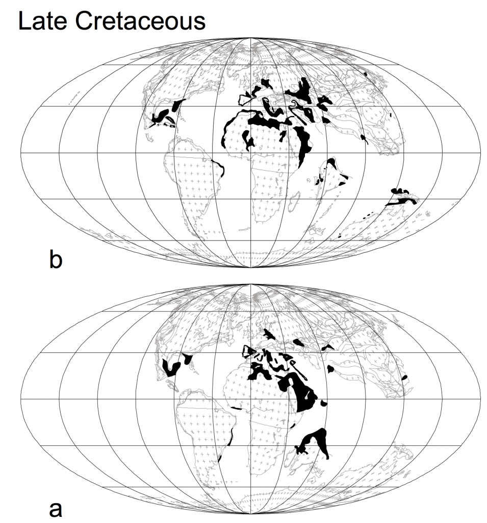
Kiessling et al. (2003) used lithofacies maps, PALEOMAP and PLATES data to reconstruct geographical maps of active carbonate platforms from the Ordovician to present day (Figure 1). For this project, we were only interested in the configuration of carbonate platforms in each geologic period since the Devonian.
We georeferenced Kiessling’s static carbonate platform maps to WGS84 using ArcGIS to create .shp files compatible with GPlates. The boundaries between the geologic periods, which define the configurations of carbonate platforms during specific time intervals, were updated with contemporary date boundaries from the 2016 ICS international chronostratigraphic chart.
Following this, a GPlates feature file was created to depict the long-term evolution of carbonate platforms. This required us to apply a kinematic model (defined by a rotation file and a plate polygon geometries) in order to overlap and assign plate IDs to the carbonate platform feature collection at the relevant timestep. Like strings on a puppet, this would allow the carbonate platforms to move with the plates in the kinematic model through time.
Using the Scotese (1990) plate model, we were able to assign plate IDs based on their overlapping position with the reconstructed plate geometry. We achieved this using a cookie-cutting technique.
Our understanding of plate kinematics and tectonics has improved significantly since the 1990s, and only the most up-to-date plate models encapsulate the knowledge and recent developments in the field of tectonics. Therefore, we rotated all carbonate platforms to their present day positions, and translated the plate IDs previously associated with the Scotese (1990) model to corresponding plate IDs from the Matthews et al. (2016) plate model.
Cookie-Cutting Technique
The notion of ‘cookie cutting‘ is to create a polygon that crops a feature of interest and assigns everything within the cookie cut region a certain feature. In our case, we were assigning plate IDs from a model to static carbonate platforms so that they could move dynamically in rotation with the plates containing the carbonate platforms.
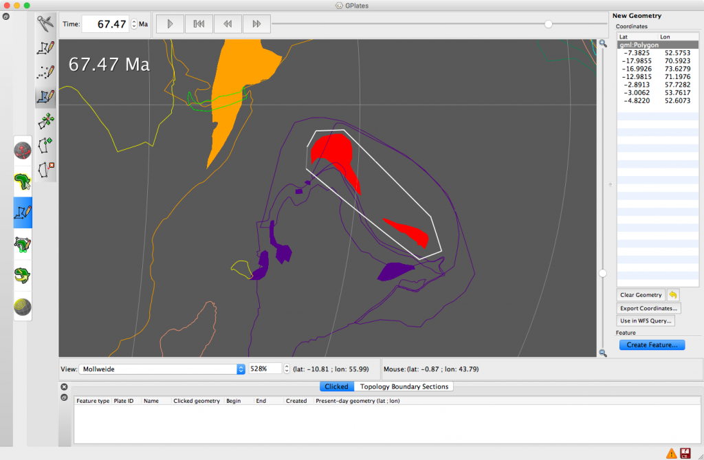
In GPlates we digitised a polygon ‘cookie cutter’ shape that contained the carbonate platform we wanted to assign a plate ID to (Figure 2) using the digitise new polygon geometry tool.
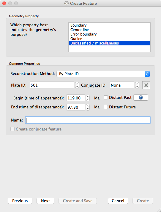
We created the new feature and gave it the plate ID of the continental polygon that it overlay. We gave it a time of appearance and disappearance based on the contemporary date boundaries, and put it in a new feature collection (Figure 3). This process was carried out in order to ‘cookie cut’ all carbonate platforms to associate them with particular plates.


Using GPlates, we were able to assign plate IDs in the following steps:
- In the ‘Features’ drop-down menu, select ‘Assign Plate IDs.’
- Specify the partitioning layers. In other words, the continental geometries of the base model and the cookie-cutter layer.
- Specify the layers to be partitioned, i.e. the carbonate platform shapefiles.
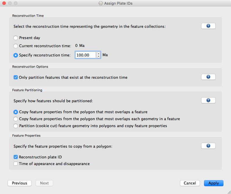
- Specify the reconstruction time and the type of partitioning (Figure 4).
- Save the carbonate platform feature collection with the new assigned plate IDs.

How long do carbonate platforms interact with volcanic arcs?
Crustal carbonates that build up along continent-ocean boundaries accumulate through time. However, they are also consumed in decarbonation processes during arc volcanism.
As we cannot know how much a developed carbonate platform is eroded, buried or consumed during volcanism, we created two models of carbonate platform evolution. The first model captures the active development of carbonate platforms (upper animation) during each geologic period and the second suggests carbonate platforms have accumulated and persisted in the crust for hundreds of millions of years (lower animation).
![]()
