Join us on March 29th at 11:00 am AEDT in Madsen Building Room 336, School of Geosciences, University of Sydney, or tune in via Zoom for the next talk in EarthByte Seimar Series to learn about the first-order question in Earth science – how tectonic plate subduction starts.
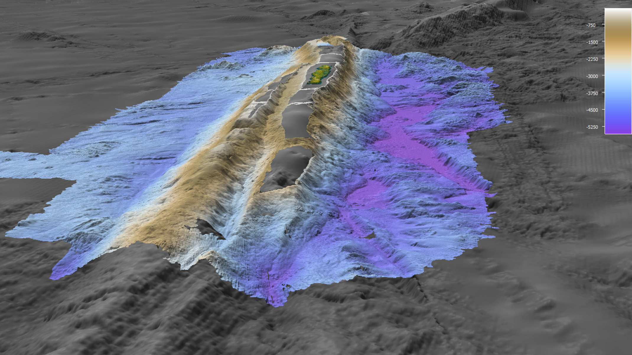
Professor MikeCoffin will discuss his research on the Macquarie Ridge Complex, which arguably constitutes the global type example for initiating plate subduction.
Don’t miss this opportunity to learn from a leading expert. We look forward to seeing you there
To register for the talk, please visit: https://www.eventbrite.com/e/earthbyte-seminar-series-prof-mike-coffin-tickets-590594633447