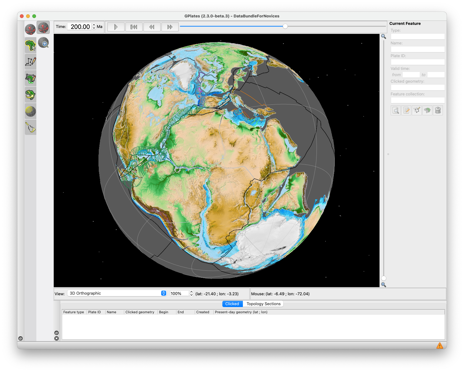
GPlates 2.5 software and data sets

GPlates Title Logo


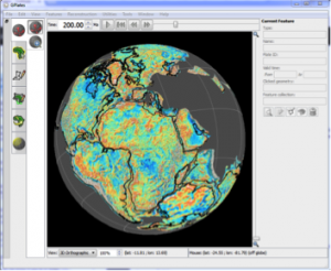
GPlates is a free desktop software for the interactive visualisation of plate-tectonics. The compilation and documentation of GPlates 2.5 data was primarily funded by AuScope National Collaborative Research Infrastructure (NCRIS).

GPlates is developed by the EarthByte Group (part of AuScope NCRIS) at the University of Sydney and the Division of Geological and Planetary Sciences (GPS) at California Institute of Technology (CalTech). … Read more…

Share

GPlates 2.4 software and data sets

GPlates Title Logo


GPlates is a free desktop software for the interactive visualisation of plate-tectonics. The compilation and documentation of GPlates 2.4 data was primarily funded by AuScope National Collaborative Research Infrastructure (NCRIS).

GPlates is developed by the EarthByte Group (part of AuScope NCRIS) at the University of Sydney and the Division of Geological and Planetary Sciences (GPS) at California Institute of Technology (CalTech). … Read more…
Share

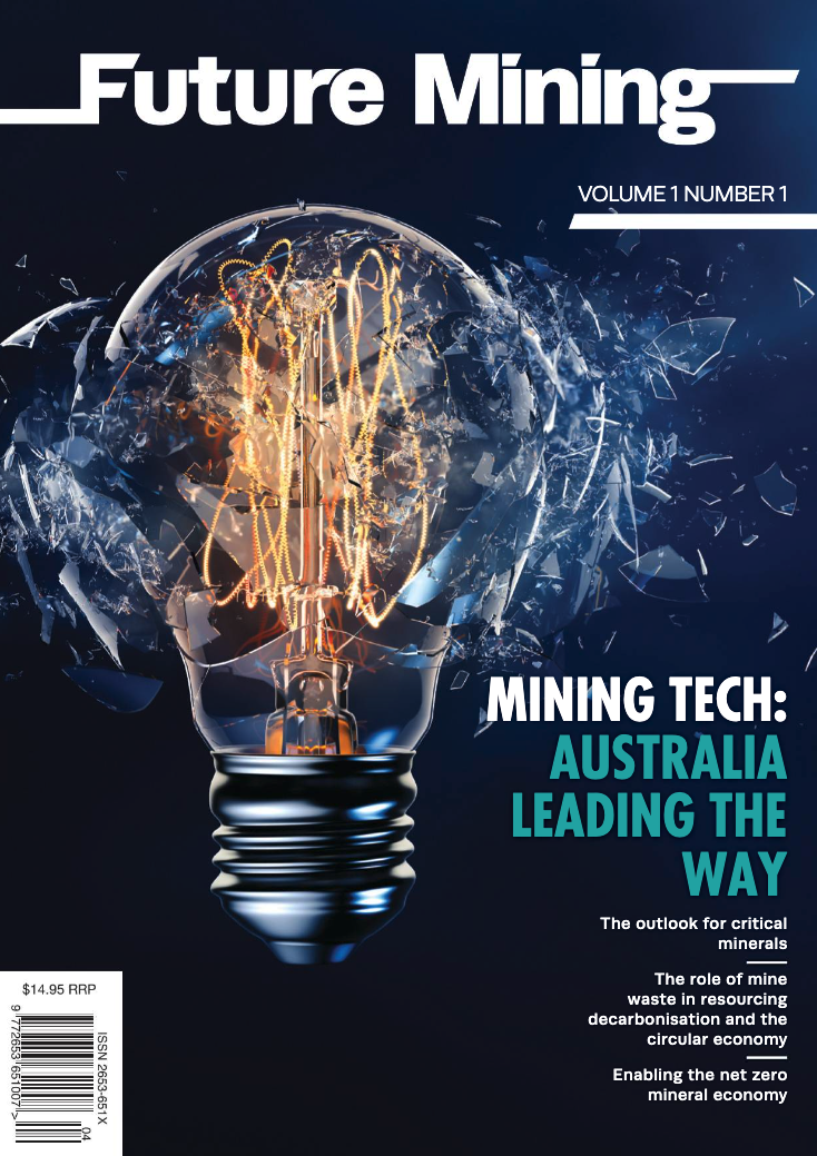
Future Mining: Travelling through geological time to find copper deposits

Travel through geological time to find copper deposits via our article in the inaugural issue of the Future Mining Magazine. https://future-mining.partica.online/future-mining/vol-1-no-1/flipbook/60/ Plate reconstructions at 1000, 400, 300, 200, 100 million years ago and at present-day. Ancient ocean basins are shown in white with continents in grey, and coloured arrows showing plate speed and direction. Mid-ocean … Read more…

The use of machine learning in processing remote sensing data for mineral exploration

ASEG will be hosting their next technical meeting on Wednesday 20th April, featuring EarthByter Ehsan Farahbakhsh Title: The use of machine learning in processing remote sensing data for mineral exploration     Time:                    5:30 pm for 6:00 pm start Address:              Level 2, 99 on York (99 York St, Sydney. Room ‘York 2’) For virtual attendance, … Read more…

GPlates 2.3 software and data sets

GPlates Title Logo


GPlates is a free desktop software for the interactive visualisation of plate-tectonics. The compilation and documentation of GPlates 2.3 data was primarily funded by AuScope National Collaborative Research Infrastructure (NCRIS).

GPlates is developed by the EarthByte Group (part of AuScope NCRIS) at the University of Sydney and the Division of Geological and Planetary Sciences (GPS) at California Institute of Technology (CalTech). … Read more…
Share

Concentration-concentration fractal modelling: a novel insight for correlation between variables in response to changes in the underlying controlling geological-geochemical processes

Behnam Sadeghi has recently published a research paper in “Ore Geology Reviews”. This paper is based on one of the methods Behnam has developed in his PhD thesis. It is about a quite novel fractal model, named Concentration-Concentration (C-C), applied to geochemical anomaly classification. Also, in this paper Behnam has proposed a Bayesian framework, using … Read more…

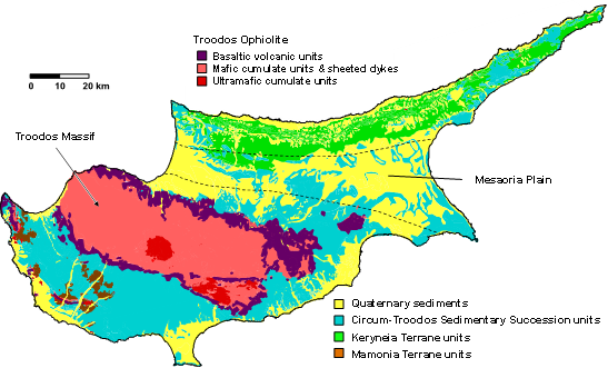
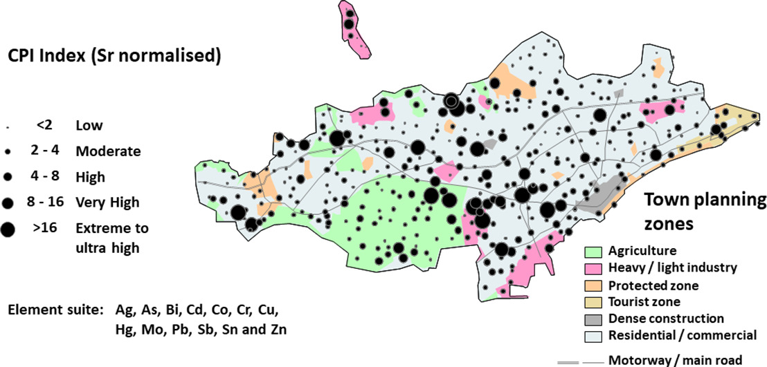
Controls on soil geochemistry fractal characteristics in Lemesos (Limassol), Cyprus

Behnam Sadeghi has recently published a research paper about urban geochemistry in Cyprus, based on soil data, and using fractal models and statistical analysis. A part of this paper is from his PhD thesis. This is a collaborative project with the Geological Survey of Cyprus and UNSW School of Biological, Earth and Environmental Sciences. ABSTRACT: This … Read more…

Computer vision-based framework for extracting tectonic lineaments from optical remote sensing data

Abstract: The extraction of tectonic lineaments from digital satellite data is a fundamental application in remote sensing. The location of tectonic lineaments such as faults and dykes are of interest for a range of applications, particularly because of their association with hydrothermal mineralization. Although a wide range of applications have utilized computer vision techniques, a … Read more…

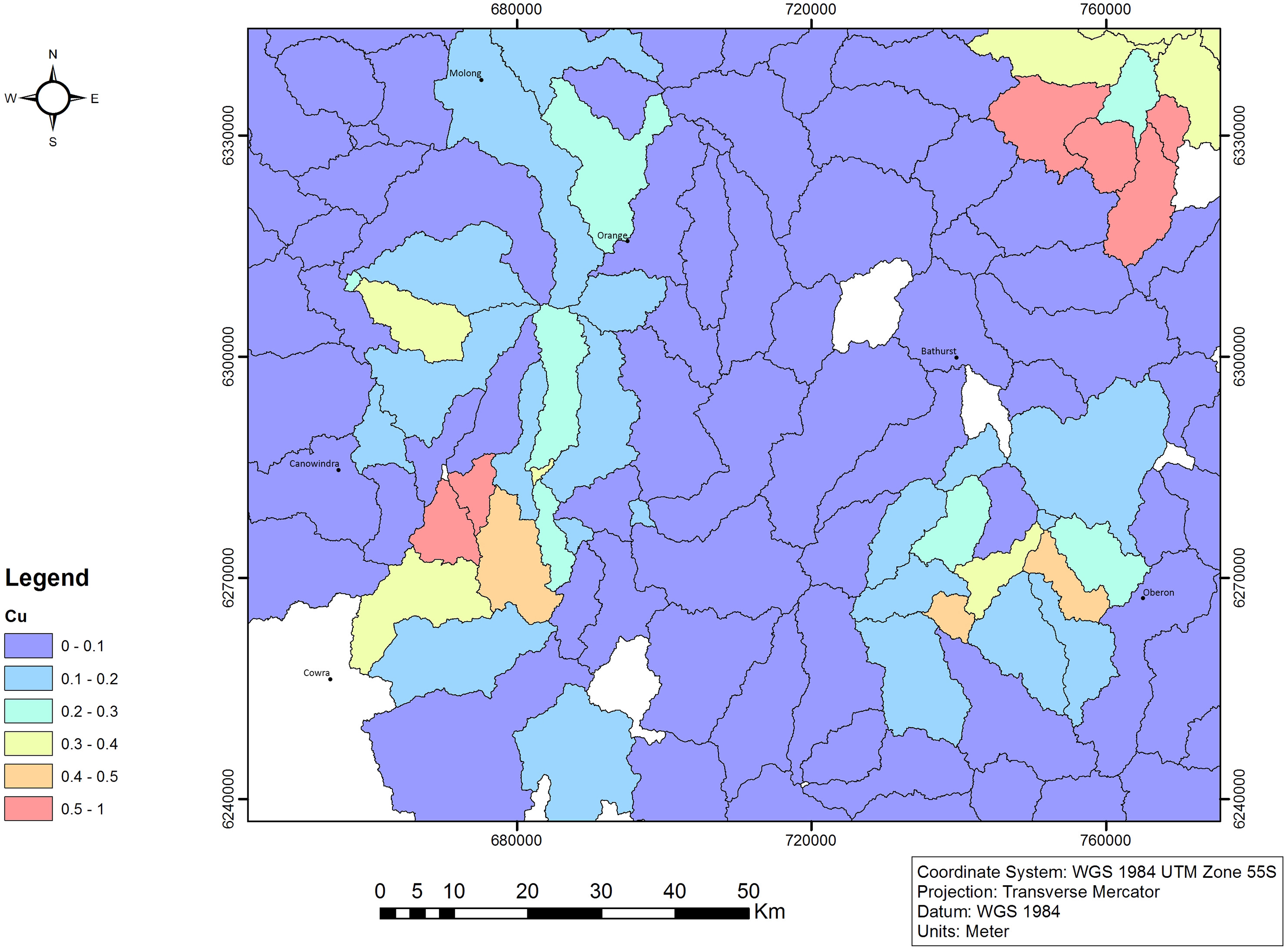
Modeling geochemical anomalies of stream sediment data through a weighted drainage catchment basin method for detecting porphyry Cu-Au mineralization

Abstract: Stream sediment surveying is a geochemical sampling method which is typically applied in the preliminary stages of mineral prospecting. Both continuous and discrete mapping approaches have been proposed to delineate geochemical anomalies at large scales using stream sediment samples. We aim to enhance the efficiency of a recent discrete mapping method called Weighted Drainage … Read more…

GPlates 2.2 software and data sets

GPlates Title Logo

GPlates 1.5 PromoGPlates is a free desktop software for the interactive visualisation of plate-tectonics. The compilation and documentation of GPlates 2.2 data was primarily funded by AuScope National Collaborative Research Infrastructure (NCRIS).

GPlates is developed by an international team of scientists and professional software developers at the EarthByte Project (part of AuScope) at the University of Sydney, the Division of Geological and Planetary Sciences (GPS) at CalTech, the Geodynamics team at the Geological Survey of Norway (NGU) and the Centre for Earth Evolution and Dynamics (CEED) at the University of Oslo. … Read more…

Share

GPlates 2.1 software and data sets

GPlates Title Logo

GPlates 1.5 PromoGPlates is a free desktop software for the interactive visualisation of plate-tectonics. The compilation and documentation of GPlates 2.1 data was primarily funded by AuScope National Collaborative Research Infrastructure (NCRIS).

GPlates is developed by an international team of scientists and professional software developers at the EarthByte Project (part of AuScope) at the University of Sydney, the Division of Geological and Planetary Sciences (GPS) at CalTech, the Geodynamics team at the Geological Survey of Norway (NGU) and the Centre for Earth Evolution and Dynamics (CEED) at the University of Oslo. … Read more…

Share

GPlates 2.0 software and data sets

GPlates 1.5 PromoGPlates is a free desktop software for the interactive visualisation of plate-tectonics. The compilation and documentation of GPlates 2.0 data was primarily funded by AuScope National Collaborative Research Infrastructure (NCRIS).

GPlates is developed by an international team of scientists and professional software developers at the EarthByte Project (part of AuScope) at the University of Sydney, the Division of Geological and Planetary Sciences (GPS) at CalTech, the Geodynamics team at the Geological Survey of Norway (NGU) and the Centre for Earth Evolution and Dynamics (CEED) at the University of Oslo.  … Read more…

Share

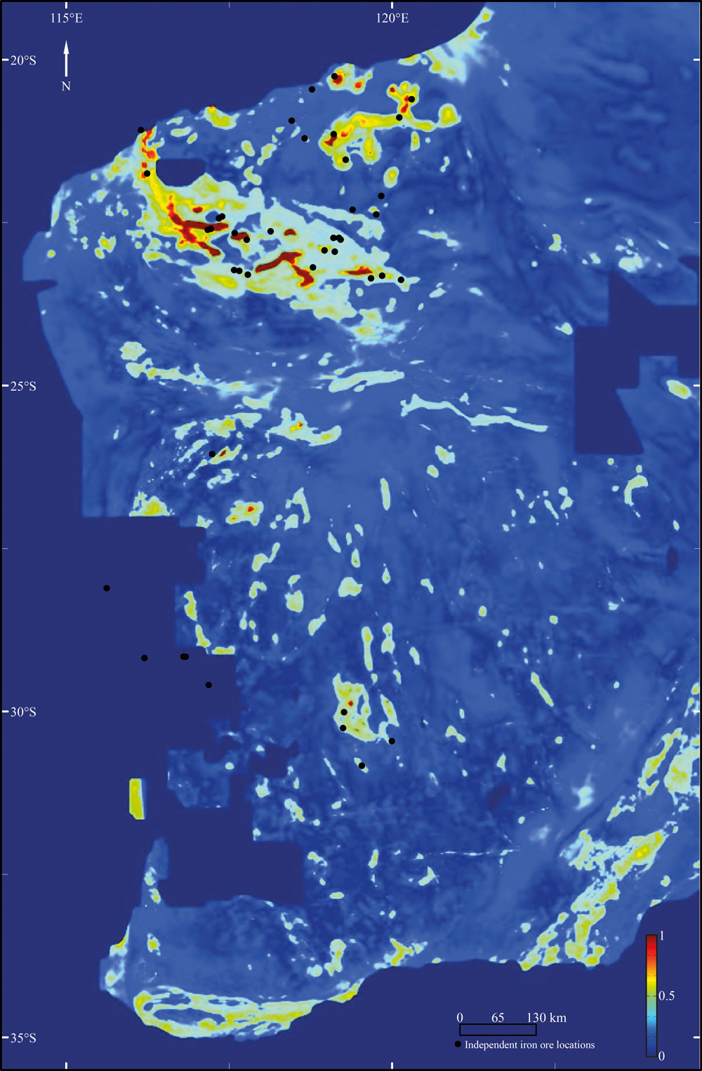
Prospectivity of Western Australian iron ore from geophysical data using a reject option classifier

Prospectivity of Western Australian iron ore from geophysical data using a reject option classifier - figure

Prospectivity of Western Australian iron ore from geophysical data using a reject option classifier - figureCitation
Merdith, A. S., Landgrebe, T. C., & Müller, R. D. (2015). Prospectivity of Western Australian iron ore from geophysical data using a reject option classifier. Ore Geology Reviews. http://dx.doi.org/10.1016/j.oregeorev.2015.03.014

Abstract
There has recently been a rapid growth in the amount and quality of digital geological and geophysical data for the majority of the Australian continent. Coupled with an increase in computational power and the rising impor- tance of computational methods, there are new possibilities for a large scale, low expenditure digital exploration of mineral deposits. Here we use a multivariate analysis of geophysical datasets to develop a methodology that utilises machine learning algorithms to build and train two-class classifiers for provincial-scale, greenfield min- eral exploration. … Read more…

Share

From data mining to opal mining

Opal NobbyDocuments
AJES Paper
CG Paper

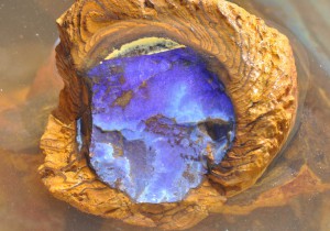
Opal is Australia’s national gemstone, however most significant opal discoveries were made in the early 1900’s – more than 100 years ago – until recently. Currently there is no formal exploration model for opal, meaning there are no widely accepted concepts or methodologies available to suggest where new opal fields may be found. … Read more…

Share