Deep Carbon Cycling Over the Past 200 Million Years: A Review of Fluxes in Different Tectonic Settings

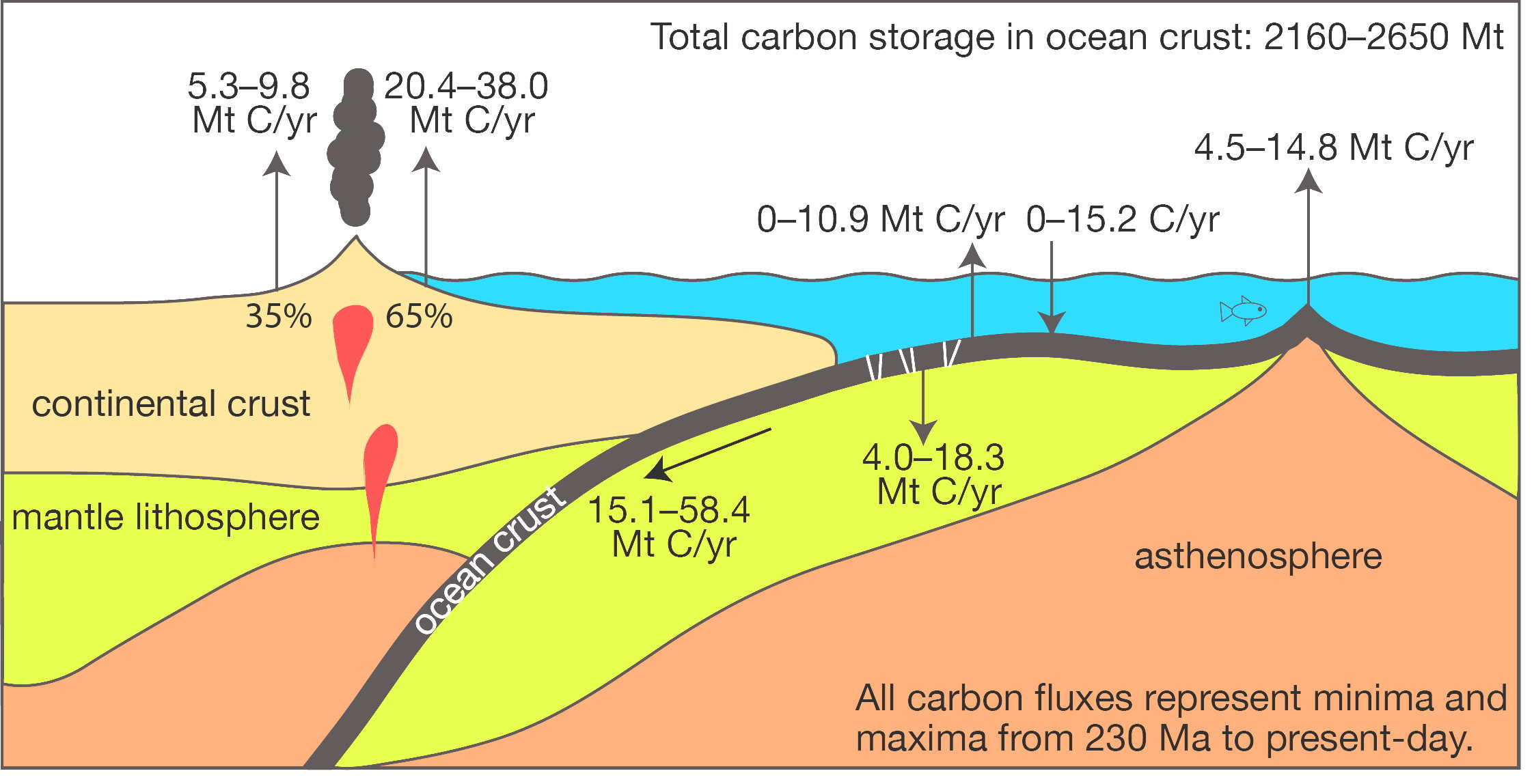
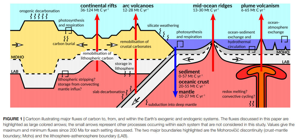
Abstract: Carbon is a key control on the surface chemistry and climate of Earth. Significant volumes of carbon are input to the oceans and atmosphere from deep Earth in the form of degassed CO2 and are returned to large carbon reservoirs in the mantle via subduction or burial. Different tectonic settings (e.g., volcanic arcs, mid-ocean … Read more…

GPlates 2.2 software and data sets

GPlates Title Logo

GPlates 1.5 PromoGPlates is a free desktop software for the interactive visualisation of plate-tectonics. The compilation and documentation of GPlates 2.2 data was primarily funded by AuScope National Collaborative Research Infrastructure (NCRIS).
GPlates is developed by an international team of scientists and professional software developers at the EarthByte Project (part of AuScope) at the University of Sydney, the Division of Geological and Planetary Sciences (GPS) at CalTech, the Geodynamics team at the Geological Survey of Norway (NGU) and the Centre for Earth Evolution and Dynamics (CEED) at the University of Oslo. … Read more…

Share

Muller et al. (2019) deforming plate reconstructions and associated digital supplements (Tectonics)

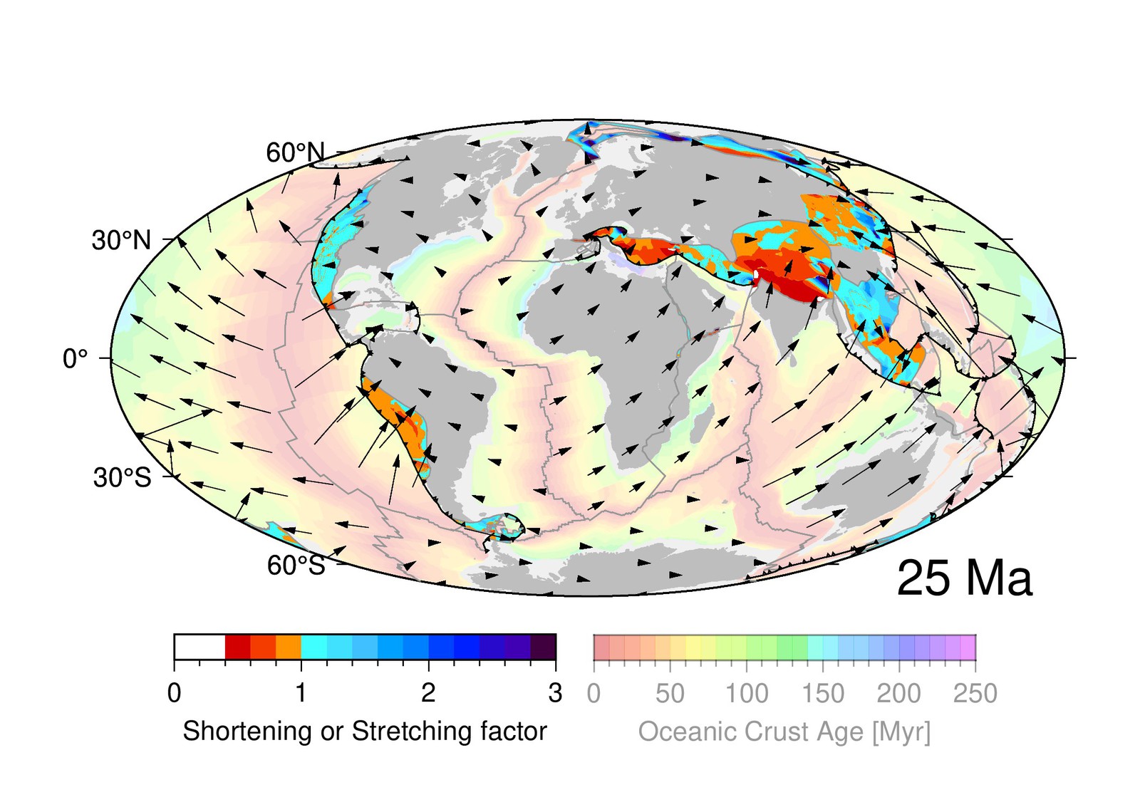
A Global Plate Model Including Lithospheric Deformation Along Major Rifts and Orogens Since the Triassic R. Dietmar Müller, Sabin Zahirovic, Simon E. Williams, John Cannon, Maria Seton, Dan J. Bower, Michael G. Tetley, Christian Heine, Eline Le Breton, Shaofeng Liu, Samuel H. J. Russell, Ting Yang, Jonathon Leonard, and Michael Gurnis Journal: Tectonics (open access) … Read more…

How Earth’s continents became twisted and contorted over millions of years

Dietmar Muller, Maria Seton and Sabin Zahirovic published an article in The Conversation on How Earth’s continents became twisted and contorted over millions of years based on their recently published paper in Tectonics. Classical plate tectonic theory was developed in the 1960s. It proposed that the outer layer of our planet is made up of a small number of rigid … Read more…

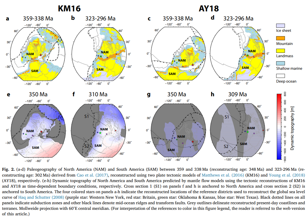
The interplay of dynamic topography and eustasy on continental flooding in the late Paleozoic

Abstract: Global sea level change can be inferred from sequence stratigraphic and continental flooding data. These methods reconstruct sea level from peri-cratonic and cratonic basins that are assumed to be tectonically stable and sometimes called reference districts, and from spatio-temporal correlations across basins. However, it has been understood that long-wavelength (typically hundreds of km) and … Read more…

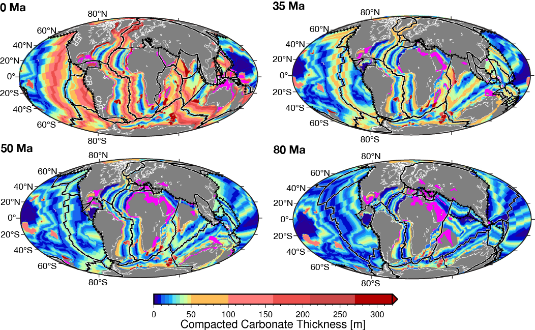
Sequestration and subduction of deep-sea carbonate in the global ocean since the Early Cretaceous

Citation: Dutkiewicz, Adriana & Müller, Dietmar & Cannon, John & Vaughan, Sioned & Zahirovic, Sabin. (2018). Sequestration and subduction of deep-sea carbonate in the global ocean since the Early Cretaceous. Geology. 10.1130/G45424.1. Abstract Deep-sea carbonate represents Earth’s largest carbon sink and one of the least-known components of the long-term carbon cycle that is intimately linked … Read more…

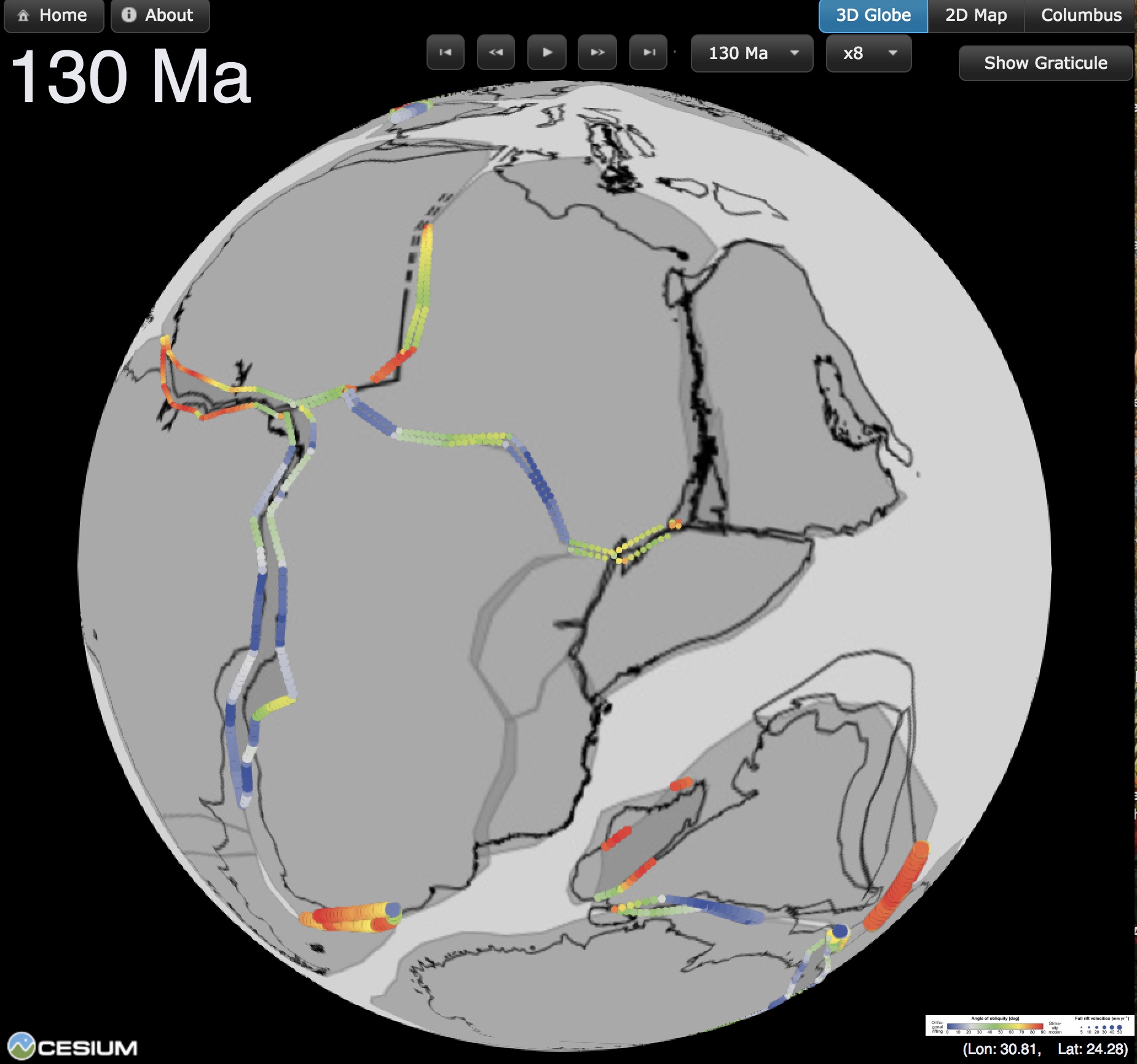
New interactive rift obliquity globe on the GPlates Portal

The ARC Basin Genesis Hub has made a new interactive rift obliquity globe available on the GPlates Portal at http://portal.gplates.org/cesium/?view=rift_ov, based on a recently published paper entitled “Oblique rifting: the rule, not the exception” in Solid Earth. This virtual globe visualizes extension velocities and obliquities within Earth’s major post-Pangea rift systems. Each circle depicts the … Read more…

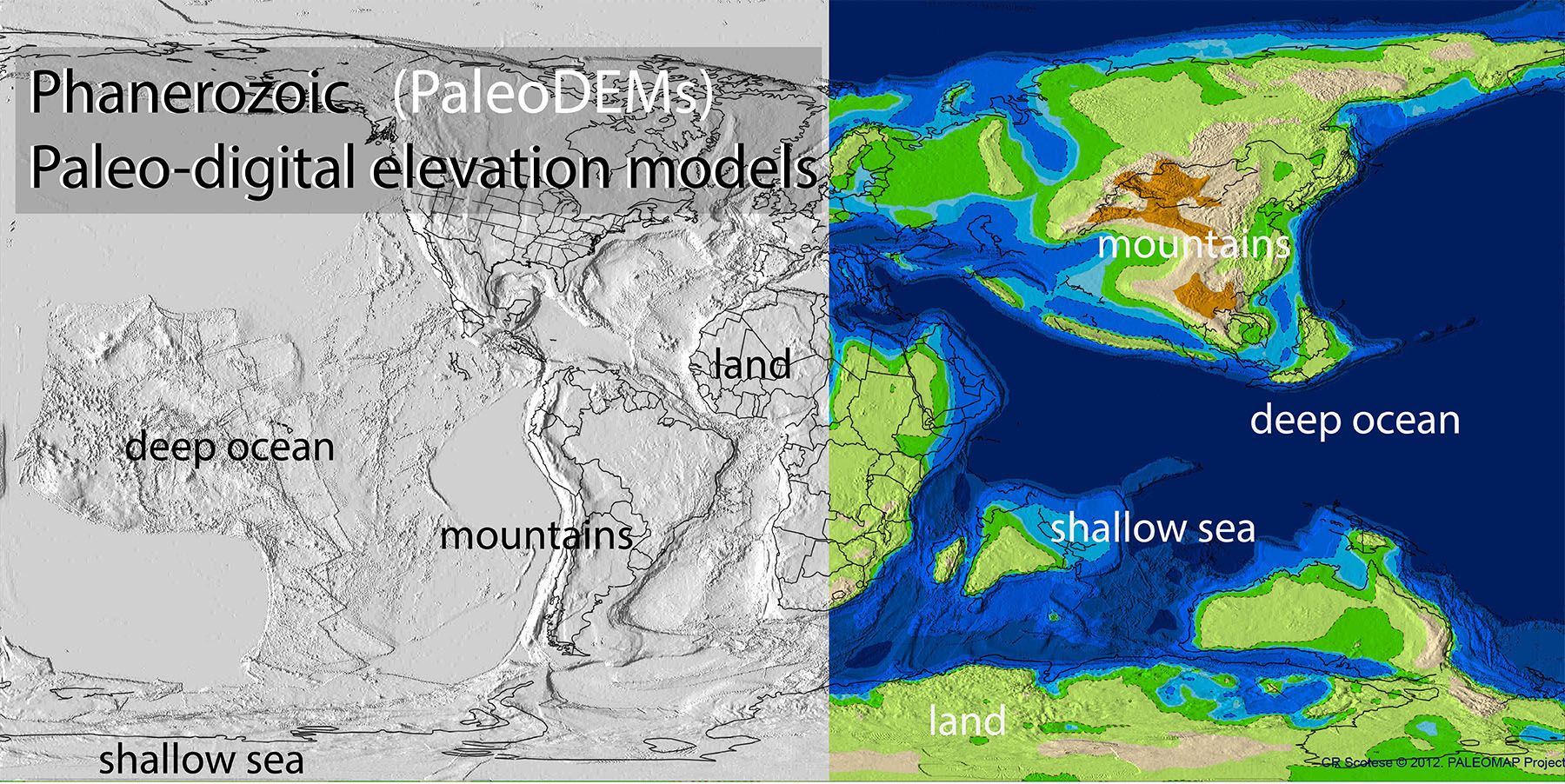
PaleoDEM Resource – Scotese and Wright (2018)

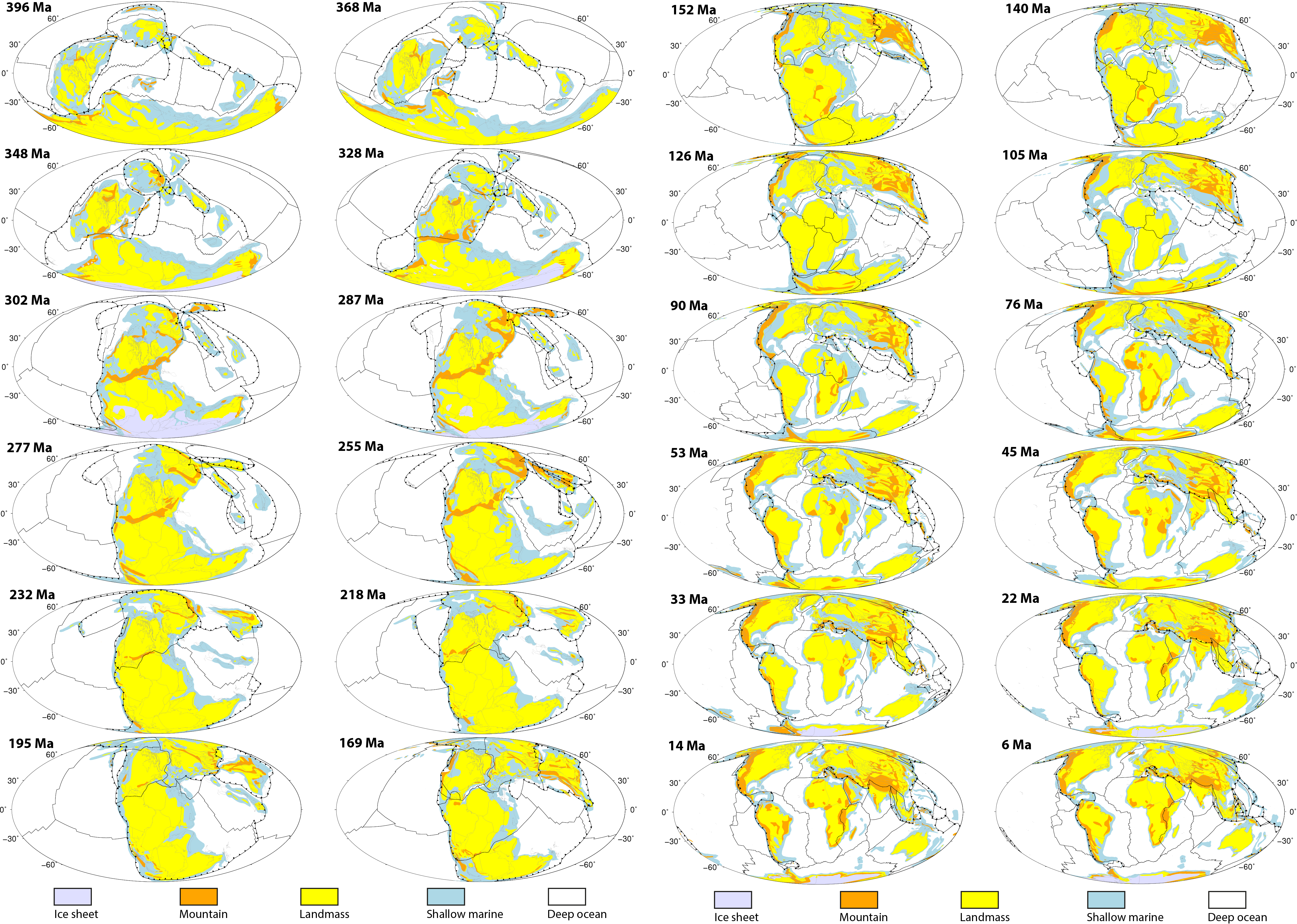
A paleo-digital elevation model (paleoDEM) is a digital representation of paleotopography and paleobathymetry that has been “reconstructed” back in time. This report describes how the 117 PALEOMAP paleoDEMS (see Supplementary Materials) were made and how they can be used to produce detailed paleogeographic maps. The paleoDEMS describe the changing distribution of deep oceans, shallow seas, … Read more…

Tectonic evolution and deep mantle structure of the eastern Tethys since the latest Jurassic

Sabin Zahirovic, Kara J. Matthews, Nicolas Flament, R. Dietmar Müller, Kevin C. Hill, Maria Seton, Michael Gurnis Earth-Science Reviews Citation: Zahirovic, S., Matthews, K.J., Flament, N., Müller, R.D., Hill, K.C., Seton, M. and Gurnis, M., 2016, Tectonic evolution and deep mantle structure of the eastern Tethys since the latest Jurassic, Earth Science Reviews, 162, 293-337. The … Read more…

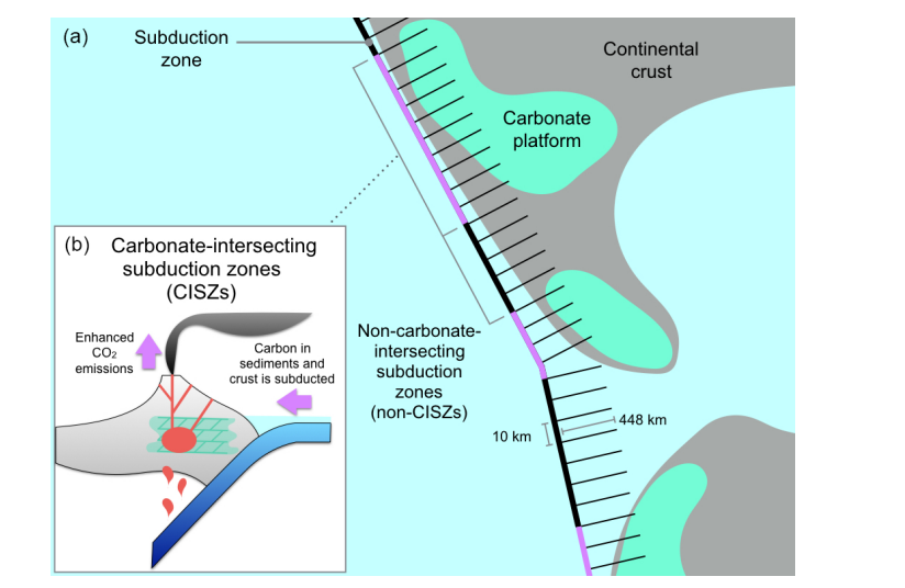
The influence of carbonate platform interactions with subduction zone volcanism on palaeo-atmospheric CO2 since the Devonian

Abstract: The CO2 liberated along subduction zones through intrusive/extrusive magmatic activity and the resulting active and diffuse outgassing influences global atmospheric CO2. However, when melts derived from subduction zones intersect buried carbonate platforms, decarbonation reactions may cause the contribution to atmospheric CO2 to be far greater than segments of the active margin that lacks buried carbon-rich rocks and … Read more…

GPlates 2.1 software and data sets

GPlates Title Logo

GPlates 1.5 PromoGPlates is a free desktop software for the interactive visualisation of plate-tectonics. The compilation and documentation of GPlates 2.1 data was primarily funded by AuScope National Collaborative Research Infrastructure (NCRIS).
GPlates is developed by an international team of scientists and professional software developers at the EarthByte Project (part of AuScope) at the University of Sydney, the Division of Geological and Planetary Sciences (GPS) at CalTech, the Geodynamics team at the Geological Survey of Norway (NGU) and the Centre for Earth Evolution and Dynamics (CEED) at the University of Oslo. … Read more…

Share

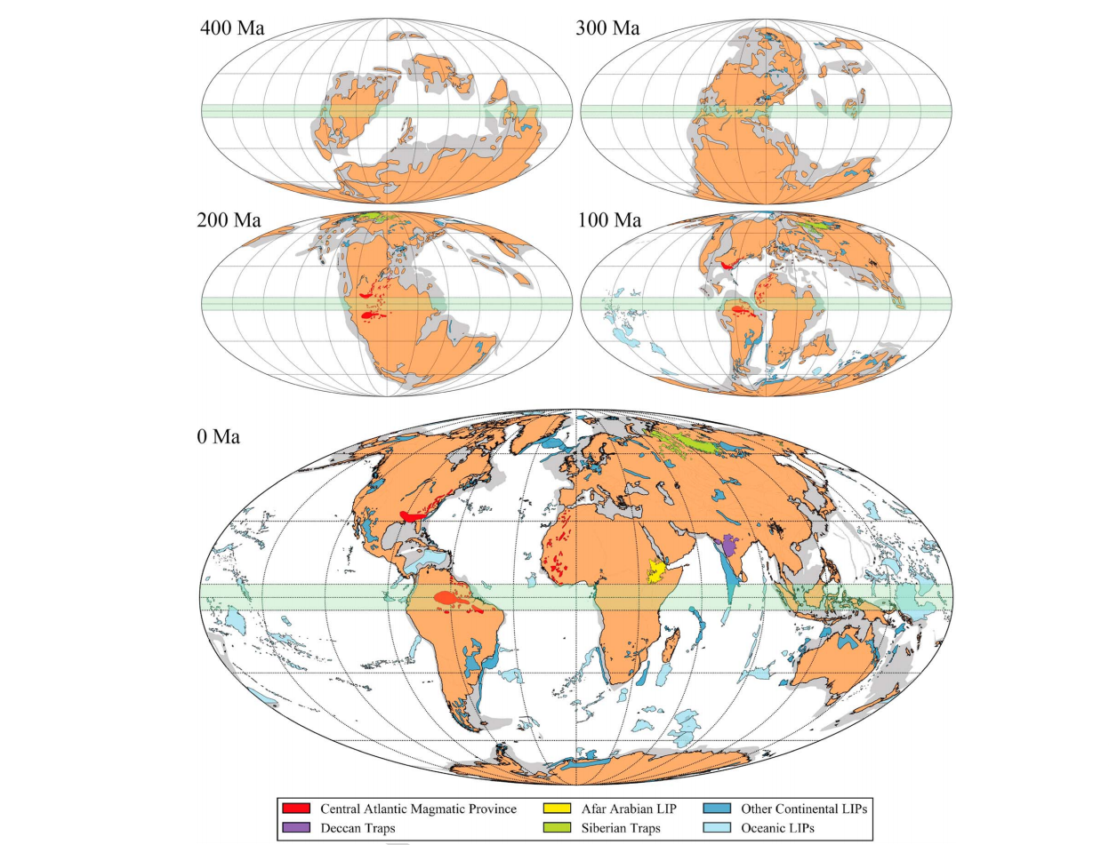
The Interplay Between the Eruption and Weathering of Large Igneous Provinces and the Deep-Time Carbon Cycle

Abstract: Although many sources of atmospheric CO2 have been estimated, the major sinks are poorly understood in a deep-time context. Here we combine plate reconstructions, the eruption ages and outlines of Large Igneous Provinces (LIPs), and the atmospheric CO2 proxy record to investigate how their eruptions and weathering within the equatorial humid zone impacted global … Read more…

Oceanic crustal carbon cycle drives 26 million-year atmospheric carbon dioxide periodicities

Citation: Müller, R.D. and Dutkiewicz, A., 2018, Oceanic crustal carbon cycle drives 26 million-year atmospheric carbon dioxide periodicities, Science Advances, 4:eaaq0500, 1-7. Atmospheric carbon dioxide (CO2) data for the last 420 million years (My) show long-term fluctuations related to supercontinent cycles as well as shorter cycles at 26–32 My whose origin is unknown. Periodicities of 26–30 … Read more…

Predicting Sediment Thickness on Vanished Ocean Crust Since 200 Ma

Citation: Dutkiewicz, A., Müller, R.D., Wang, X., O’Callaghan, S., Cannon, J., Wright, N.M., 2017. Predicting sediment thickness on vanished ocean crust since 200 Ma. Geochemistry, Geophysics, Geosystems, 18, 4586–4603. Tracing sedimentation through time on existing and vanished seafloor is imperative for constraining long-term eustasy and for calculating volumes of subducted deep-sea sediments that contribute to global … Read more…

Improving global paleogeography since the late Paleozoic using paleobiology

Author List: Wenchao Cao, Sabin Zahirovic, Nicolas Flament, Simon Williams, Jan Golonka, Dietmar Müller Citation: Cao, W., Zahirovic, S., Flament, N., Williams, S., Golonka, J., and Müller, R. D., 2017, Improving global paleogeography since the late Paleozoic using paleobiology: Biogeosciences, v. 14, no. 23, p. 5425-5439. Paleogeographic maps, linked to plate tectonic reconstructions, are key components required for climate models … Read more…

Kinematic constraints on the Rodinia to Gondwana transition

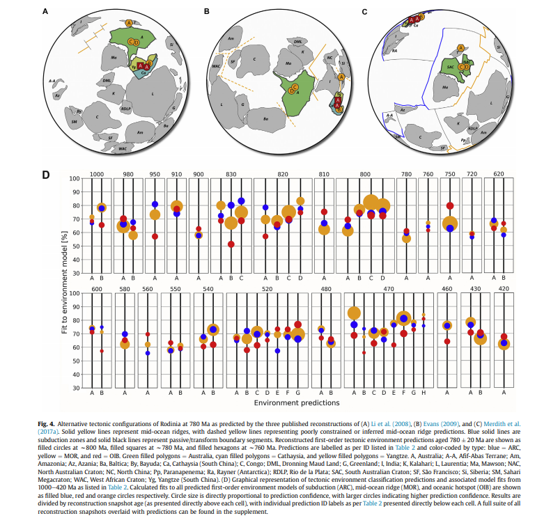
Author List: Andrew Merdith, Simon Williams, Dietmar Müller & Alan Collins. Citation: Merdith, Andrew & Williams, Simon & Müller, Dietmar & Collins, Alan. (2017). Kinematic constraints on the Rodinia-Gondwana transition. Precambrian Research. 299. . 10.1016/j.precamres.2017.07.013. Abstract: Earth’s plate tectonic history during the breakup of the supercontinent Pangea is well constrained from the seafloor spreading record, but evolving plate configurations during … Read more…

Global Dynamic Topography Models

Cao et al., 2018

Cao, X., Flament, N, Müller, R.D. and Li, S., 2018, The dynamic topography of eastern China since the latest Jurassic Period , Tectonics.

Müller et al., 2017

Müller R.D., Hassan, R., Gurnis, M., Flament, N., and Williams, S.E., 2017, Dynamic topography of passive continental margins and their hinterlands since the Cretaceous, Gondwana Research, in press, accepted 21 March 2017.

Barnett-Moore et al., 2017

Barnett-Moore, N., R. Hassan, R. D. Müller, S. E. Williams, and N. Flament (2017), Dynamic topography and eustasy controlled the paleogeographic evolution of northern Africa since the mid-Cretaceous , Tectonics, 36, 929–944, doi:10.1002/2016TC004280.

 Rubey et al., 2017

Rubey, M., Brune, S., Heine, C., Davies, D. R., Williams, S. E., and Müller R. D.: Global patterns of Earth’s dynamic topography since the Jurassic, Solid Earth Discuss., doi:10.5194/se-2017-26, in press, 2017.

Müller et al., 2016

Müller, R. D., Flament, N., Matthews, K. J., Williams, S. E., & Gurnis, M. (2016). Formation of Australian continental margin highlands driven by plate-mantle interaction.. Earth and Planetary Science Letters, 441, 60-70. http://dx.doi.org/10.1016/j.epsl.2016.02.025

Zahirovic et al., 2016a

Zahirovic, S., Matthews, K. J., Flament, N., Müller, R. D., Hill, K. C., Seton, M., & Gurnis, M. (2016a). Tectonic evolution and deep mantle structure of the eastern Tethys since the latest Jurassic. Earth-Science Reviews, 162, 293-337.

Zahirovic et al.,2016b

Zahirovic, S., Flament, N., Müller, R. D, Seton, M., & Gurnis, M. (2016b). Large fluctuations of shallow seas in low-lying Southeast Asia driven by mantle flow. Geochemistry, Geophysics, Geosystems, 17(9), 3589-3607.

Flament et al., 2015

Flament, N., Gurnis, M., Müller R. D., Bower, D. J., & Husson, L. (2015). Influence of subduction history on South American topography. Earth and Planetary Science Letters, 430, 9-18, http://dx.doi.org/10.1016/j.epsl.2015.08.006.

Seton et al., 2015

Seton, M., Flament, N., Whittaker, J., Müller, R. D., Gurnis, M., & Bower, D. J. (2015). Ridge subduction sparked reorganization of the Pacific plate-mantle system 60.50 million years ago. Geophysical Research Letters, 42(6), 1732-1740.

Bower et al., 2015

Bower, D. J., Gurnis, M., & Flament, N. (2015). Assimilating lithosphere and slab history in 4-D Earth models. Physics of the Earth and Planetary Interiors, 238, 8-22.

Flament et al., 2014

Read more…

Share

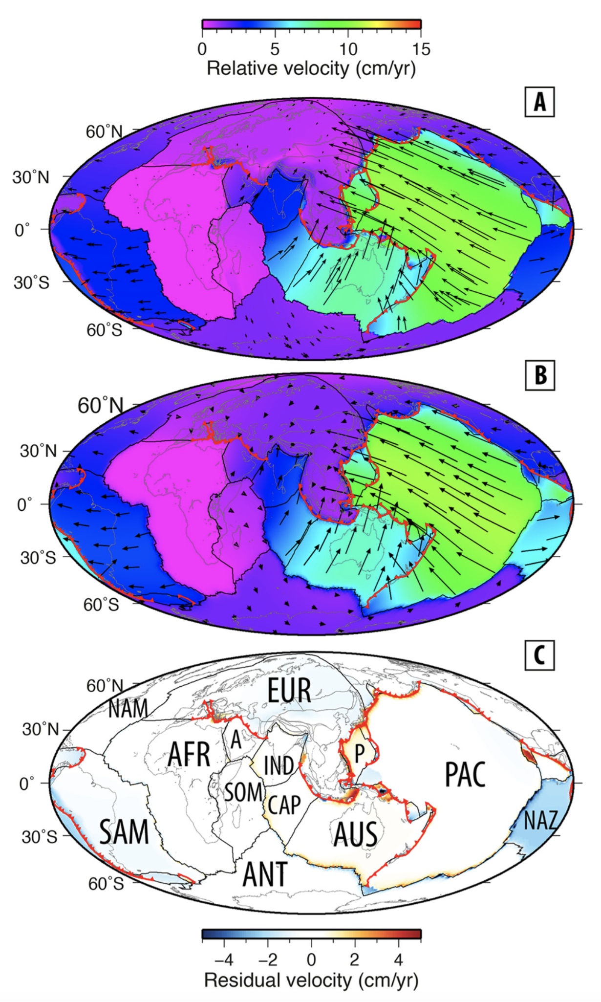
Tectonic speed limits from plate kinematic reconstructions

Abstract The motion of plates and continents on the planet’s surface are a manifestation of long-term mantle convection and plate tectonics. Present-day plate velocities provide a snapshot of this ongoing process, and have been used to infer controlling factors on the speeds of plates and continents. However, present-day velocities do not capture plate behaviour over … Read more…

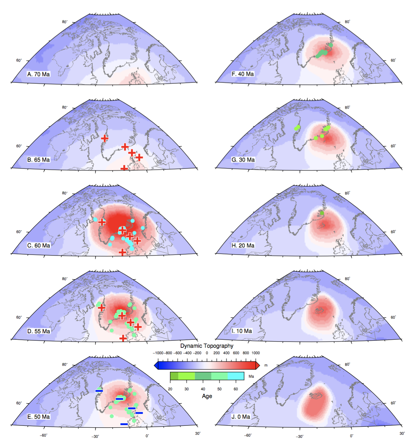
The deep Earth origin of the Iceland plume and its effects on regional surface uplift and subsidence

Abstract The present-day seismic structure of the mantle under the North Atlantic Ocean indicates that the Iceland hotspot represents the surface expression of a deep mantle plume, which is thought to have erupted in the North Atlantic domain during the Palaeocene. The spatial and temporal evolution of the plume since its eruption is still highly … Read more…

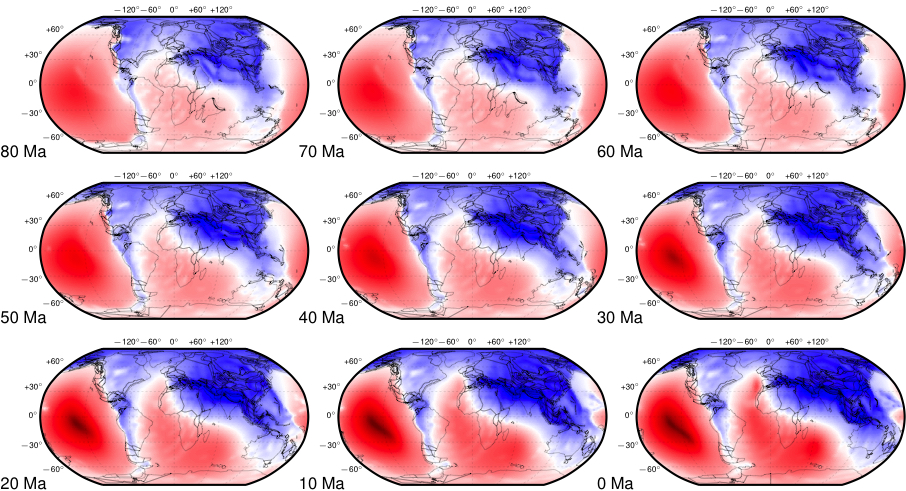
Dynamic topography of passive continental margins and their hinterlands since the Cretaceous

Author List: Dietmar Müller, Rakib Hassan, Michael Garnis, Nicolas Flament, Simon Williams. Citation: Müller, Dietmar & Hassan, Rakib & Gurnis, M & Flament, Nicolas & Williams, Simon. (2018). Dynamic topography of passive continental margins and their hinterlands since the Cretaceous. Gondwana Research. . 10.1016/j.gr.2017.04.028. Abstract: Even though it is well accepted that the Earth’s surface topography has been … Read more…

A full-plate global reconstruction of the Neoproterozoic

Author List:  Andrew Merdith, Alan Collins, Simon Williams, Sergei Pisarevsky, John Foden, Donnelly Archibald, Morgan Blades, Brandon Alessio, Sheree Armistead, Diana Plavsa, Chris Clark, Dietmar Müller Citation: Merdith, Andrew & Collins, Alan & Williams, Simon & Pisarevsky, Sergei & Foden, John & Archibald, Donnelly & Blades, Morgan & Alessio, Brandon & Armistead, Sheree & Plavsa, Diana & Clark, Chris … Read more…

A Paleomagnetic Database for GPlates: PaleoPoles, Declination Arrows, and PaleoLatitudes

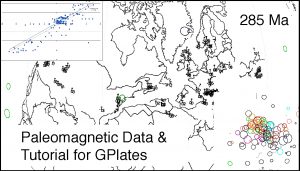
A PaleomagneticPmag Tutorial Image Database that has been assembled for use with the program, GPlates.  The paleomagnetic database presented here is made up of 1638 paleopoles compiled by Rob Van der Voo for his book, Paleomagnetism of the Atlantic, Tethys, and Iapetus Oceans.  In addition to the spreadsheet of paleopoles, we have constructed five feature collections that can be used to visualize the paleomagnetic data using GPlates:  1) site localities, 2) paleopoles, 3) declination arrows, 4) paleolatitude labels, and a set of time-dependent rasters which plot the site locations, paleopoles, declination arrows, and paleolatitude labels on a set of plate tectonic reconstructions ( 0 – 540 Ma).  The last section of this report is a detailed discussion of the paleomagnetic data for three-time intervals (40Ma, 285Ma, and 450Ma).  The Supplementary Materials includes a program, “PaleoPolePlotter”, which GPlates users can use to build paleopoles, declination arrows, and paleolatitude labels from user-defined data sets
Read more…

Share

Global plate boundary evolution and kinematics since the late Paleozoic

Matthews++_SummaryFigCitation

Matthews, K.J., Maloney, K.T., Zahirovic, S., Williams, S.E., Seton, M., and Müller, R.D. (2016). Global plate boundary evolution and kinematics since the late Paleozoic, Global and Planetary Change, 146, 226-250. DOI: 10.1016/j.gloplacha.2016.10.002

Abstract

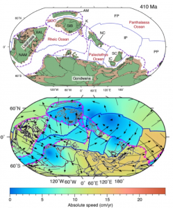
Many aspects of deep-time Earth System models, including mantle convection, paleoclimatology, paleobiogeography and the deep Earth carbon cycle, require high-resolution plate models that include the evolution of the mosaic of plate boundaries through time. We present the first continuous late Paleozoic to present-day global plate model with evolving plate boundaries, building on and extending two previously published models for the late Paleozoic (410–250 Ma) and Mesozoic-Cenozoic (230–0 Ma). We ensure continuity during the 250–230 Ma transition period between the two models, update the absolute reference frame of the Mesozoic-Cenozoic model and add a new Paleozoic reconstruction for the Baltica-derived Alexander Terrane, now accreted to western North America. This 410–0 Ma open access model provides a framework for deep-time whole Earth modelling and acts as a base for future extensions and refinement.

This model is available with a default mantle reference frame, a hybrid reference frame using moving hotspots and a true polar wander corrected paleomagnetic reference frame (see paper for details) as well as with a paleomagnetic reference frame. For times before 83 Ma, the Pacific is shifted to maintain relative motions with the circum-Pangea continents – largely due to the fact that no paleomagnetic reference frames exist that extend to the birth age of the Pacific Plate. The paleomagnetic reference frame is based on data from Torsvik, T. H., Van der Voo, R., Preeden, U., Mac Niocaill, C., Steinberger, B., Doubrovine, P. V., van Hinsbergen, D. J., Domeier, M., Gaina, C., and Tohver, E., 2012, Phanerozoic polar wander, palaeogeography and dynamics: Earth-Science Reviews, v. 114, no. 3, p. 325-368, DOI: 10.1016/j.earscirev.2012.06.007.

Read more…

Share

GPlates 2.0 software and data sets

GPlates 1.5 PromoGPlates is a free desktop software for the interactive visualisation of plate-tectonics. The compilation and documentation of GPlates 2.0 data was primarily funded by AuScope National Collaborative Research Infrastructure (NCRIS).
GPlates is developed by an international team of scientists and professional software developers at the EarthByte Project (part of AuScope) at the University of Sydney, the Division of Geological and Planetary Sciences (GPS) at CalTech, the Geodynamics team at the Geological Survey of Norway (NGU) and the Centre for Earth Evolution and Dynamics (CEED) at the University of Oslo.  … Read more…

Share

Setting up environment for DCO Demo Analysis

Mac Environment 1.1) Install Anaconda Navigate to the continuum website and download the python 2.7 Mac version of Anaconda, if not already installed. In terminal, where the downloaded anaconda source code is stored, type: bash Anaconda2-4.1.1-MacOSX-x86_64.sh Select yes to all of the prompts. Edit your .bash_profile to include the anaconda bin path in the PATH … Read more…

Ocean Basin Evolution and Global-Scale Plate Reorganization Events Since Pangea Breakup

Author List: Dietmar Müller, Maria Seton, Sabin Zahirovic, Simon Williams, Kara Matthews, Nicky Wright, Grace Shephard, Kayla Maloney, Nicholas Barnett-Moore, Maral Hosseinpour, Dan Bower and John Cannon. Citation: Müller, R.D., Seton, M., Zahirovic, S., Williams, S.E., Matthews, K.J., Wright, N.M., Shephard, G.E., Maloney, K.T., Barnett-Moore, N., Hosseinpour, M., Bower, D.J., & Cannon, J. (2016). Ocean Basin Evolution and … Read more…

Workflow explained: The interaction of subduction zone volcanism with carbonate platforms and continents

Objectives Our two objectives of analysis were to (a) quantify the km-long length areas of interaction of subduction zone volcanism with carbonate platforms and (b) characterise the subduction volcanism as either continental or intra-oceanic depending on the proximity of the subduction zones to continent-ocean boundaries. In regards to the first objective, we are interested in cases where subduction-related … Read more…

PALEOMAP PaleoAtlas for GPlates

PaleoAtlas_imageThe PALEOMAP PaleoAtlas for GPlates consists of 91 paleogeographic maps spanning the Phanerozoic and late Neoproterozoic. The PaleoAtlas can be directly loaded into GPlates as a Time Dependent Raster file. The paleogeographic maps in the PaleoAtlas illustrate the ancient configuration of the ocean basins and continents, as well as important topographic and bathymetric features such as mountains, lowlands, shallow sea, continental shelves, and deep oceans. This tutorial also describes how the maps in the PaleoAtlas were made, documents the sources of information used to make the paleogeographic maps, and provides instructions how to plot user-defined paleodata on the paleogeographic maps using the program PaleoDataPlotter. Read more…

Share

Ocean basin evolution and global-scale plate reorganization events since Pangea breakup

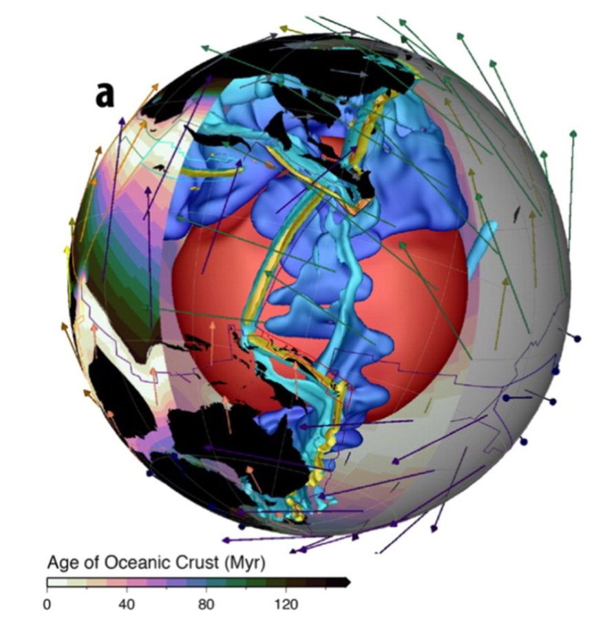
Seafloor ages from Müller et al.

Seafloor ages from Müller et al.Citation
Müller R.D., Seton, M., Zahirovic, S., Williams, S.E., Matthews, K.J., Wright, N.M., Shephard, G.E., Maloney, K.T., Barnett-Moore, N., Hosseinpour, M., Bower, D.J., Cannon, J., 2016. Ocean basin evolution and global-scale plate reorganization events since Pangea breakup, Annual Review of Earth and Planetary Sciences, Vol 44, 107-138. DOI: 10.1146/annurev-earth-060115-012211.

Abstract
We present a revised global plate motion model with continuously closing plate boundaries ranging from the Triassic at 230 Ma to the present day, assess differences between alternative absolute plate motion models, and review global tectonic events. Relatively high mean absolute plate motion rates around 9–10 cm yr-1 between 140 and 120 Ma may be related to transient plate motion accelerations driven by the successive emplacement of a sequence of large igneous provinces during that time. … Read more…

Share

Prospectivity of Western Australian iron ore from geophysical data using a reject option classifier

Prospectivity of Western Australian iron ore from geophysical data using a reject option classifier - figure

Prospectivity of Western Australian iron ore from geophysical data using a reject option classifier - figureCitation
Merdith, A. S., Landgrebe, T. C., & Müller, R. D. (2015). Prospectivity of Western Australian iron ore from geophysical data using a reject option classifier. Ore Geology Reviews. http://dx.doi.org/10.1016/j.oregeorev.2015.03.014

Abstract
There has recently been a rapid growth in the amount and quality of digital geological and geophysical data for the majority of the Australian continent. Coupled with an increase in computational power and the rising impor- tance of computational methods, there are new possibilities for a large scale, low expenditure digital exploration of mineral deposits. Here we use a multivariate analysis of geophysical datasets to develop a methodology that utilises machine learning algorithms to build and train two-class classifiers for provincial-scale, greenfield min- eral exploration. … Read more…

Share