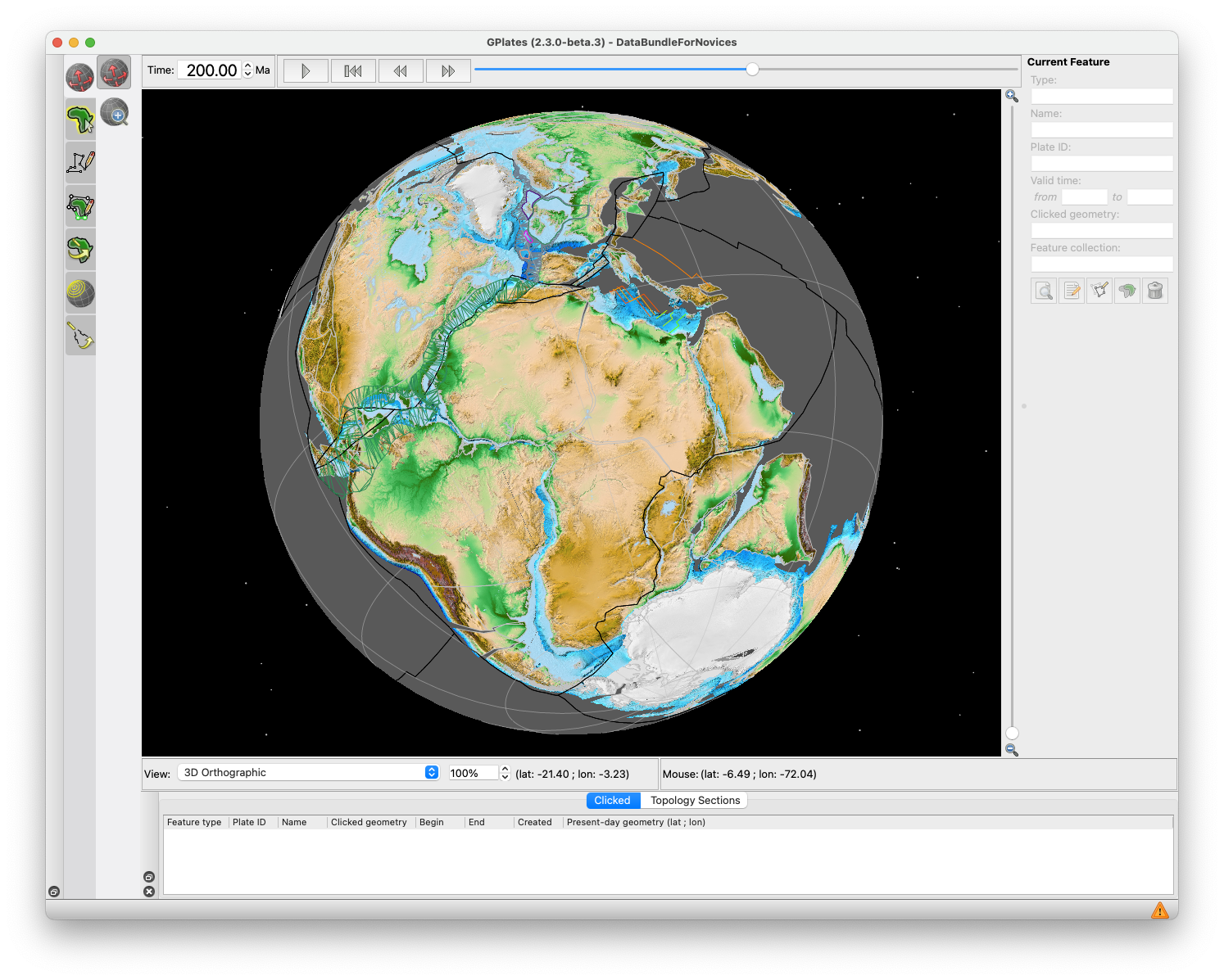
GPlates 2.5 software and data sets

GPlates Title Logo


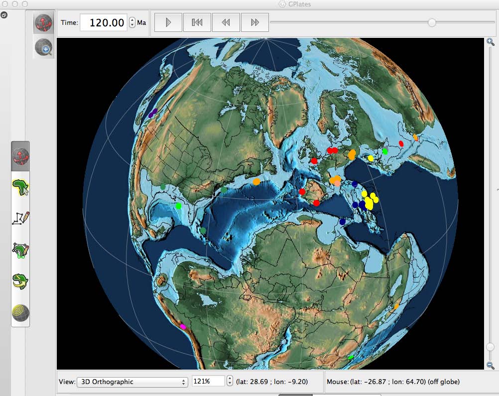
GPlates is a free desktop software for the interactive visualisation of plate-tectonics. The compilation and documentation of GPlates 2.5 data was primarily funded by AuScope National Collaborative Research Infrastructure (NCRIS).

GPlates is developed by the EarthByte Group (part of AuScope NCRIS) at the University of Sydney and the Division of Geological and Planetary Sciences (GPS) at California Institute of Technology (CalTech). … Read more…


Share

GPlates 2.4 software and data sets

GPlates Title Logo


GPlates is a free desktop software for the interactive visualisation of plate-tectonics. The compilation and documentation of GPlates 2.4 data was primarily funded by AuScope National Collaborative Research Infrastructure (NCRIS).

GPlates is developed by the EarthByte Group (part of AuScope NCRIS) at the University of Sydney and the Division of Geological and Planetary Sciences (GPS) at California Institute of Technology (CalTech). … Read more…
Share

GPlates 2.3 software and data sets

GPlates Title Logo


GPlates is a free desktop software for the interactive visualisation of plate-tectonics. The compilation and documentation of GPlates 2.3 data was primarily funded by AuScope National Collaborative Research Infrastructure (NCRIS).

GPlates is developed by the EarthByte Group (part of AuScope NCRIS) at the University of Sydney and the Division of Geological and Planetary Sciences (GPS) at California Institute of Technology (CalTech). … Read more…
Share

Integration of Selective Dimensionality Reduction Techniques for Mineral Exploration Using ASTER Satellite Data

Abstract: There are a significant number of image processing methods that have been developed during the past decades for detecting anomalous areas, such as hydrothermal alteration zones, using satellite images. Among these methods, dimensionality reduction or transformation techniques are known to be a robust type of methods, which are helpful, as they reduce the extent … Read more…

Surrogate-assisted Bayesian inversion for landscape and basin evolution models

Abstract: The complex and computationally expensive nature of landscape evolution models poses significant challenges to the inference and optimization of unknown model parameters. Bayesian inference provides a methodology for estimation and uncertainty quantification of unknown model parameters. In our previous work, we developed parallel tempering Bayeslands as a framework for parameter estimation and uncertainty quantification … Read more…

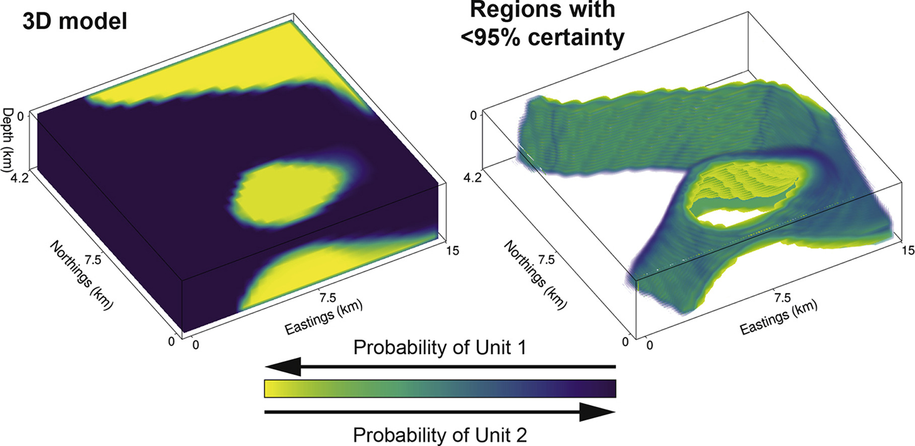
Bayesian geological and geophysical data fusion for the construction and uncertainty quantification of 3D geological models

Abstract: Traditional approaches to develop 3D geological models employ a mix of quantitative and qualitative scientific techniques, which do not fully provide quantification of uncertainty in the constructed models and fail to optimally weight geological field observations against constraints from geophysical data. Here, using the Bayesian Obsidian software package, we develop a methodology to fuse … Read more…

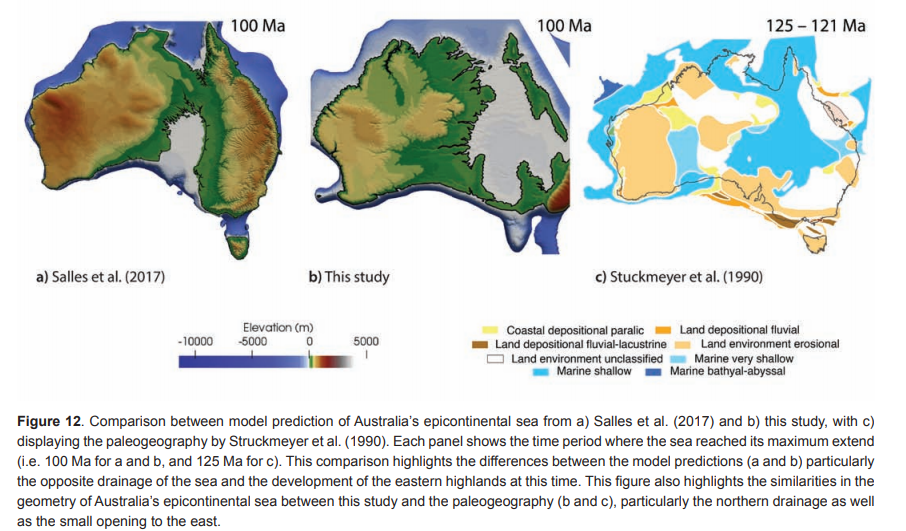
Tectonic, geodynamic and surface process driving forces of Australia’s paleogeography since the Jurassic

Abstract: Today the eastern highlands of Australia are significantly more elevated than western Australia, but the continent’s geodynamic evolution suggests that the opposite was the case during Cretaceous times, when the Eromanga Sea dominated the eastern Australian landscape. Previous geodynamic and surface processes models have been used to simulate the evolution of this seaway, but … Read more…

GPlates 2.2 software and data sets

GPlates Title Logo

GPlates 1.5 PromoGPlates is a free desktop software for the interactive visualisation of plate-tectonics. The compilation and documentation of GPlates 2.2 data was primarily funded by AuScope National Collaborative Research Infrastructure (NCRIS).

GPlates is developed by an international team of scientists and professional software developers at the EarthByte Project (part of AuScope) at the University of Sydney, the Division of Geological and Planetary Sciences (GPS) at CalTech, the Geodynamics team at the Geological Survey of Norway (NGU) and the Centre for Earth Evolution and Dynamics (CEED) at the University of Oslo. … Read more…

Share

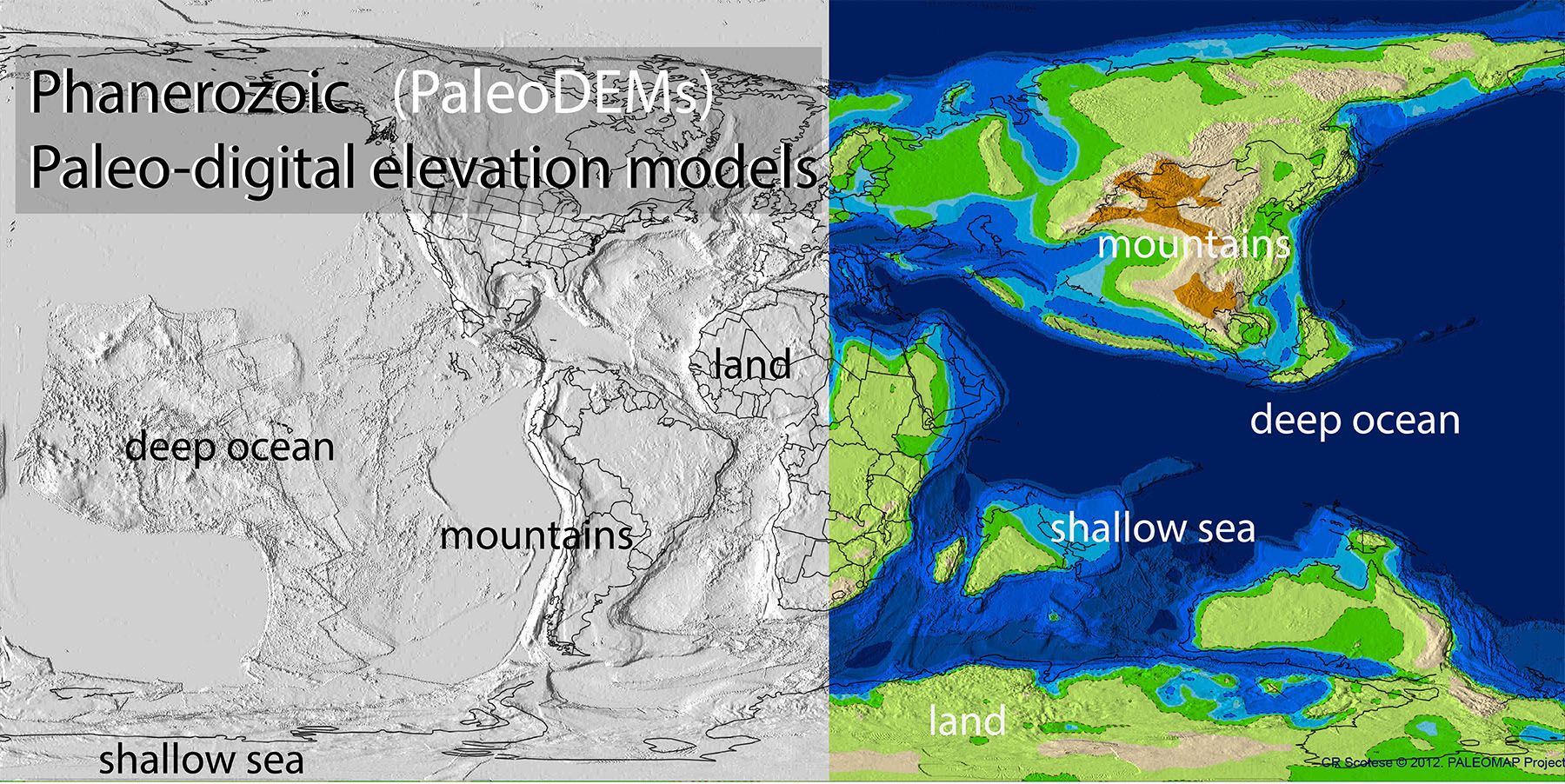
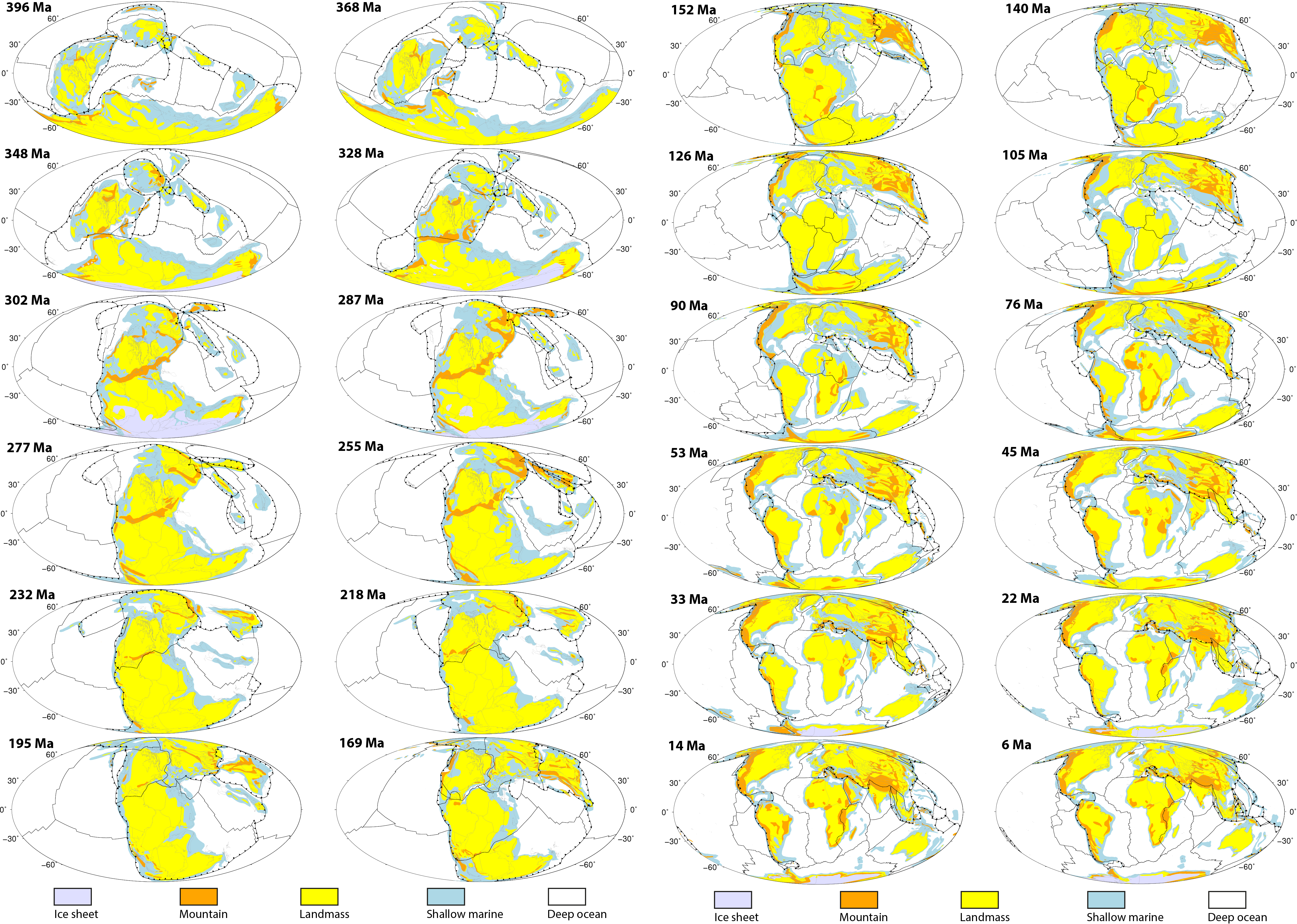
PaleoDEM Resource – Scotese and Wright (2018)

A paleo-digital elevation model (paleoDEM) is a digital representation of paleotopography and paleobathymetry that has been “reconstructed” back in time. This report describes how the 117 PALEOMAP paleoDEMS (see Supplementary Materials) were made and how they can be used to produce detailed paleogeographic maps. The paleoDEMS describe the changing distribution of deep oceans, shallow seas, … Read more…

GPlates 2.1 software and data sets

GPlates Title Logo

GPlates 1.5 PromoGPlates is a free desktop software for the interactive visualisation of plate-tectonics. The compilation and documentation of GPlates 2.1 data was primarily funded by AuScope National Collaborative Research Infrastructure (NCRIS).

GPlates is developed by an international team of scientists and professional software developers at the EarthByte Project (part of AuScope) at the University of Sydney, the Division of Geological and Planetary Sciences (GPS) at CalTech, the Geodynamics team at the Geological Survey of Norway (NGU) and the Centre for Earth Evolution and Dynamics (CEED) at the University of Oslo. … Read more…

Share

Improving global paleogeography since the late Paleozoic using paleobiology

Author List: Wenchao Cao, Sabin Zahirovic, Nicolas Flament, Simon Williams, Jan Golonka, Dietmar Müller Citation: Cao, W., Zahirovic, S., Flament, N., Williams, S., Golonka, J., and Müller, R. D., 2017, Improving global paleogeography since the late Paleozoic using paleobiology: Biogeosciences, v. 14, no. 23, p. 5425-5439. Paleogeographic maps, linked to plate tectonic reconstructions, are key components required for climate models … Read more…

GPlates 2.0 software and data sets

GPlates 1.5 PromoGPlates is a free desktop software for the interactive visualisation of plate-tectonics. The compilation and documentation of GPlates 2.0 data was primarily funded by AuScope National Collaborative Research Infrastructure (NCRIS).

GPlates is developed by an international team of scientists and professional software developers at the EarthByte Project (part of AuScope) at the University of Sydney, the Division of Geological and Planetary Sciences (GPS) at CalTech, the Geodynamics team at the Geological Survey of Norway (NGU) and the Centre for Earth Evolution and Dynamics (CEED) at the University of Oslo.  … Read more…

Share

PALEOMAP PaleoAtlas for GPlates

PaleoAtlas_imageThe PALEOMAP PaleoAtlas for GPlates consists of 91 paleogeographic maps spanning the Phanerozoic and late Neoproterozoic. The PaleoAtlas can be directly loaded into GPlates as a Time Dependent Raster file. The paleogeographic maps in the PaleoAtlas illustrate the ancient configuration of the ocean basins and continents, as well as important topographic and bathymetric features such as mountains, lowlands, shallow sea, continental shelves, and deep oceans. This tutorial also describes how the maps in the PaleoAtlas were made, documents the sources of information used to make the paleogeographic maps, and provides instructions how to plot user-defined paleodata on the paleogeographic maps using the program PaleoDataPlotter. Read more…

Share

Evaluating global paleoshoreline models for the Cretaceous and Cenozoic

Early CretaceousCitation
Heine, C., Yeo, L. G., & Müller, R. D. (2015). Evaluating global paleoshoreline models for the Cretaceous and Cenozoic. Australian Journal of Earth Sciences, (ahead-of-print), 1-13., doi: 10.1080/08120099.2015.1018321.

Summary
Paleoshoreline maps represent the distribution of land and sea through geologic time. These compilations provide excellent proxies for evaluating the contributions non-tectonic vertical crustal motions, such as mantle convection-driven dynamic topography, to the flooding histories of continental platforms. Until now, such data have not been available as a globally coherent compilation. Here, we present and evaluate a set of Cretaceous and Cenozoic global shoreline data extracted from two independent published global paleogeographic atlases. … Read more…

Share

Towards community-driven paleogeographic reconstructions: integrating open-access paleogeographic and paleobiology data with plate tectonics

PaleobioSummary
A variety of paleogeographic reconstructions have been published, with applications ranging from paleoclimate, ocean circulation and faunal radiation models to resource exploration; yet their uncertainties remain difficult to assess as they are generally presented as low-resolution static maps. We present a methodology for ground-truthing the digital Palaeogeographic Atlas of Australia by linking the GPlates plate reconstruction tool to the global Paleobiology Database and a Phanerozoic plate motion model.

We develop a spatio-temporal data mining workflow to validate the Phanerozoic Palaeogeographic Atlas of Australia with paleoenvironments derived from fossil data. … Read more…

Share

The IntraCONtinental basinS (ICONS) atlas

The ICONS atlas is a collection of basin data for over 240 intracontinental sedimentary basins, displaying crustal structure data, computed extension factors and tectonic subsidence grids and derivatives thereof as well as the dynamic topography evolution of a given basin. The atlas was compiled by Christian Heine as part of his PhD project investigating the formation and … Read more…

Herold et al. 2008 Mid Miocene topographic/bathymetric dataset

Citation: Herold, N., Seton, M., Muller, R.D., You, Y. and Huber, M. (2008). Middle Miocene tectonic boundary conditions for use in climate models. Geochemisty Geophysics Geosystems, 9, Q10009. doi:10.1029/2008GC002046. Abstract: Utilizing general circulation models (GCMs) for paleoclimate study requires the construction of appropriate model boundary conditions. We present a middle Miocene paleotopographic and paleobathymetric reconstruction … Read more…