GPlates 2.5 software and data sets

GPlates Title Logo


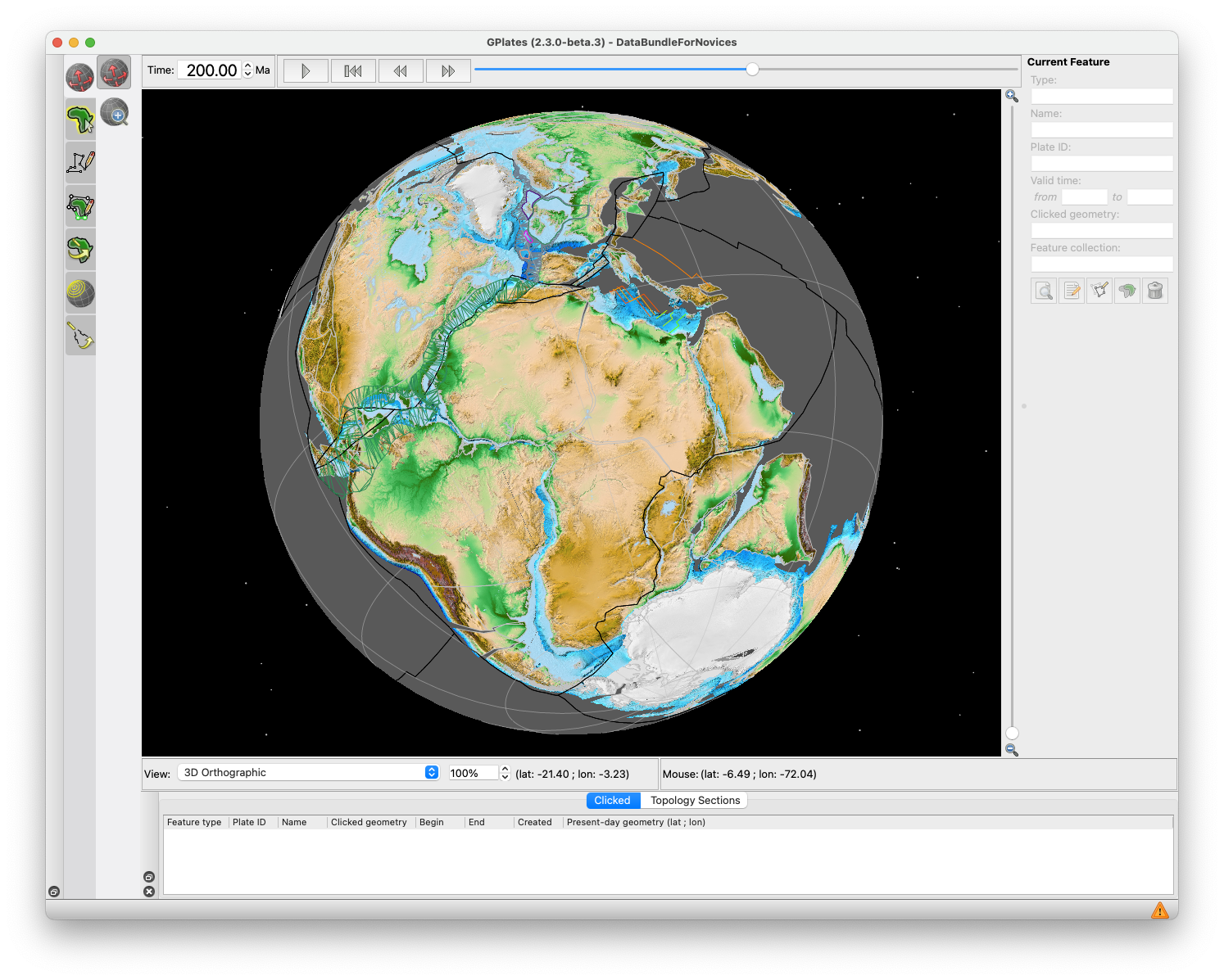
GPlates is a free desktop software for the interactive visualisation of plate-tectonics. The compilation and documentation of GPlates 2.5 data was primarily funded by AuScope National Collaborative Research Infrastructure (NCRIS).

GPlates is developed by the EarthByte Group (part of AuScope NCRIS) at the University of Sydney and the Division of Geological and Planetary Sciences (GPS) at California Institute of Technology (CalTech). … Read more…

Share

GPlates 2.4 software and data sets

GPlates Title Logo


GPlates is a free desktop software for the interactive visualisation of plate-tectonics. The compilation and documentation of GPlates 2.4 data was primarily funded by AuScope National Collaborative Research Infrastructure (NCRIS).

GPlates is developed by the EarthByte Group (part of AuScope NCRIS) at the University of Sydney and the Division of Geological and Planetary Sciences (GPS) at California Institute of Technology (CalTech). … Read more…
Share

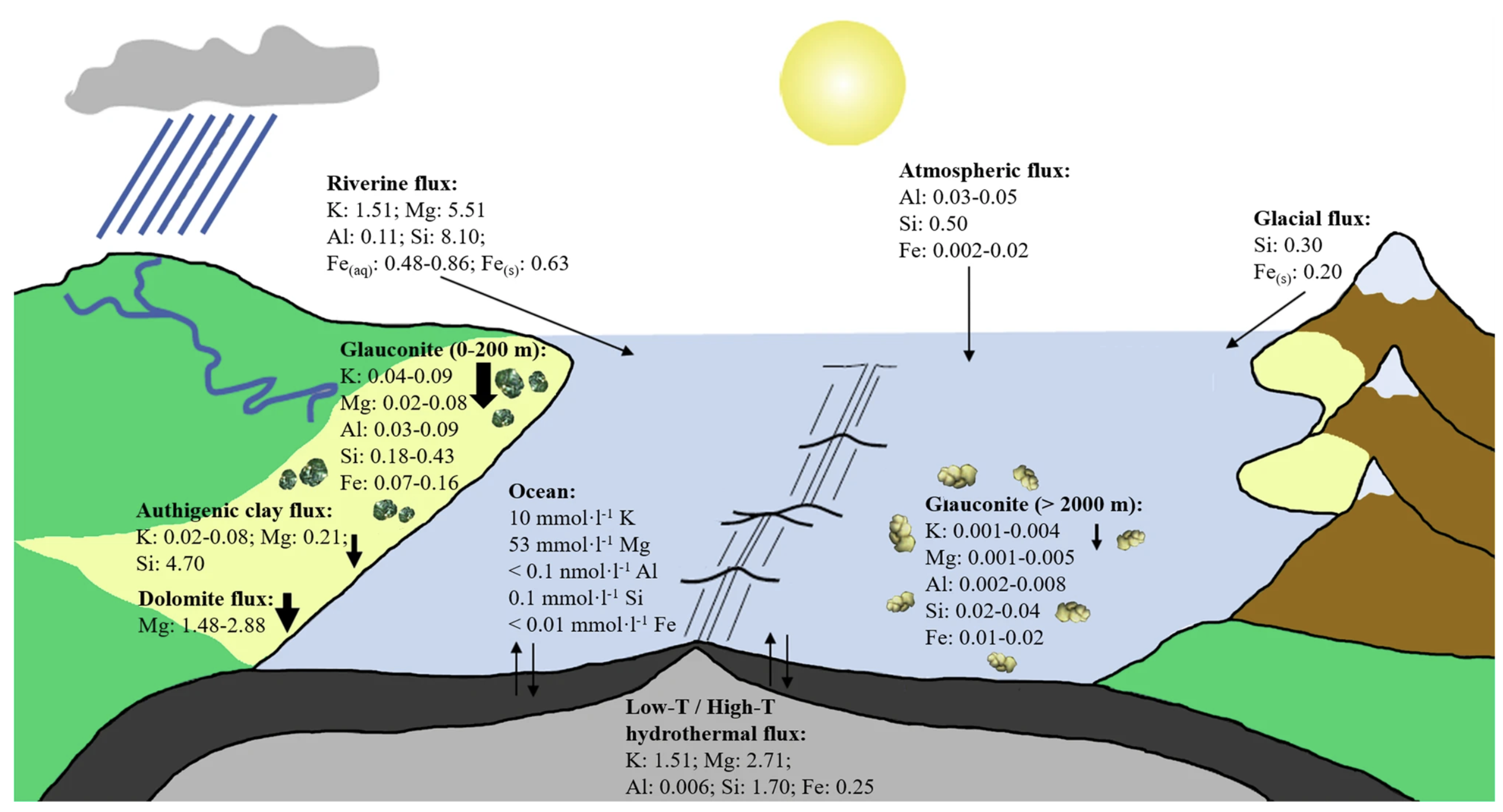
Nature Commmunications: Impact of green clay authigenesis on element sequestration in marine settings

Retrograde clay mineral reactions (reverse weathering), including glauconite formation, are first-order controls on element sequestration in marine sediments. Here, we report substantial element sequestration by glauconite formation in shallow marine settings from the Triassic to the Holocene, averaging 3 ± 2 mmol·cm−²·kyr−1 for K, Mg and Al, 16 ± 9 mmol·cm−²·kyr−1 for Si and 6 ± 3 mmol·cm−²·kyr−1 for Fe, which is ~2 orders of magnitude higher … Read more…

GPlates 2.3 software and data sets

GPlates Title Logo


GPlates is a free desktop software for the interactive visualisation of plate-tectonics. The compilation and documentation of GPlates 2.3 data was primarily funded by AuScope National Collaborative Research Infrastructure (NCRIS).

GPlates is developed by the EarthByte Group (part of AuScope NCRIS) at the University of Sydney and the Division of Geological and Planetary Sciences (GPS) at California Institute of Technology (CalTech). … Read more…
Share

Surrogate-assisted Bayesian inversion for landscape and basin evolution models

Abstract: The complex and computationally expensive nature of landscape evolution models poses significant challenges to the inference and optimization of unknown model parameters. Bayesian inference provides a methodology for estimation and uncertainty quantification of unknown model parameters. In our previous work, we developed parallel tempering Bayeslands as a framework for parameter estimation and uncertainty quantification … Read more…

Bayesian geological and geophysical data fusion for the construction and uncertainty quantification of 3D geological models

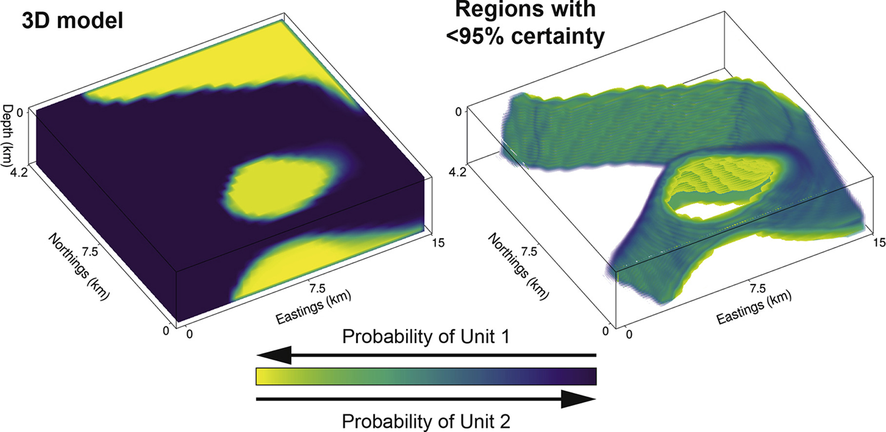
Abstract: Traditional approaches to develop 3D geological models employ a mix of quantitative and qualitative scientific techniques, which do not fully provide quantification of uncertainty in the constructed models and fail to optimally weight geological field observations against constraints from geophysical data. Here, using the Bayesian Obsidian software package, we develop a methodology to fuse … Read more…

Concentration-concentration fractal modelling: a novel insight for correlation between variables in response to changes in the underlying controlling geological-geochemical processes

Behnam Sadeghi has recently published a research paper in “Ore Geology Reviews”. This paper is based on one of the methods Behnam has developed in his PhD thesis. It is about a quite novel fractal model, named Concentration-Concentration (C-C), applied to geochemical anomaly classification. Also, in this paper Behnam has proposed a Bayesian framework, using … Read more…

Controls on soil geochemistry fractal characteristics in Lemesos (Limassol), Cyprus

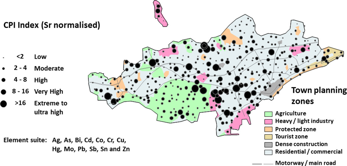
Behnam Sadeghi has recently published a research paper about urban geochemistry in Cyprus, based on soil data, and using fractal models and statistical analysis. A part of this paper is from his PhD thesis. This is a collaborative project with the Geological Survey of Cyprus and UNSW School of Biological, Earth and Environmental Sciences. ABSTRACT: This … Read more…

GPlates 2.2 software and data sets

GPlates Title Logo

GPlates 1.5 PromoGPlates is a free desktop software for the interactive visualisation of plate-tectonics. The compilation and documentation of GPlates 2.2 data was primarily funded by AuScope National Collaborative Research Infrastructure (NCRIS).

GPlates is developed by an international team of scientists and professional software developers at the EarthByte Project (part of AuScope) at the University of Sydney, the Division of Geological and Planetary Sciences (GPS) at CalTech, the Geodynamics team at the Geological Survey of Norway (NGU) and the Centre for Earth Evolution and Dynamics (CEED) at the University of Oslo. … Read more…

Share

GPlates 2.1 software and data sets

GPlates Title Logo

GPlates 1.5 PromoGPlates is a free desktop software for the interactive visualisation of plate-tectonics. The compilation and documentation of GPlates 2.1 data was primarily funded by AuScope National Collaborative Research Infrastructure (NCRIS).

GPlates is developed by an international team of scientists and professional software developers at the EarthByte Project (part of AuScope) at the University of Sydney, the Division of Geological and Planetary Sciences (GPS) at CalTech, the Geodynamics team at the Geological Survey of Norway (NGU) and the Centre for Earth Evolution and Dynamics (CEED) at the University of Oslo. … Read more…

Share

Predicting Sediment Thickness on Vanished Ocean Crust Since 200 Ma

Citation: Dutkiewicz, A., Müller, R.D., Wang, X., O’Callaghan, S., Cannon, J., Wright, N.M., 2017. Predicting sediment thickness on vanished ocean crust since 200 Ma. Geochemistry, Geophysics, Geosystems, 18, 4586–4603. Tracing sedimentation through time on existing and vanished seafloor is imperative for constraining long-term eustasy and for calculating volumes of subducted deep-sea sediments that contribute to global … Read more…

GPlates 2.0 software and data sets

GPlates 1.5 PromoGPlates is a free desktop software for the interactive visualisation of plate-tectonics. The compilation and documentation of GPlates 2.0 data was primarily funded by AuScope National Collaborative Research Infrastructure (NCRIS).

GPlates is developed by an international team of scientists and professional software developers at the EarthByte Project (part of AuScope) at the University of Sydney, the Division of Geological and Planetary Sciences (GPS) at CalTech, the Geodynamics team at the Geological Survey of Norway (NGU) and the Centre for Earth Evolution and Dynamics (CEED) at the University of Oslo.  … Read more…

Share

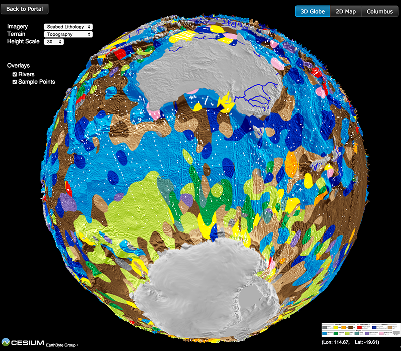
Seafloor lithology of the ocean basins

Lithology globe Aus Ant view

Lithology globe Aus Ant viewCitation
Dutkiewicz, A., Müller, R. D., O’Callaghan, S., & Jónasson, H. (2015). Census of seafloor sediments in the world’s ocean. Geology, G36883-1. doi: 10.1130/G36883.1.

Abstract
Knowing the patterns of distribution of sediments in the global ocean is critical for understanding biogeochemical cycles and how deep-sea deposits respond to environmental change at the sea surface. We present the first digital map of seafloor lithologies based on descriptions of nearly 14,500 samples from original cruise reports, interpolated using a support vector machine algorithm. We show that sediment distribution is more complex, with significant deviations from earlier hand-drawn maps, and that major lithologies occur in drastically different proportions globally. … Read more…

Share

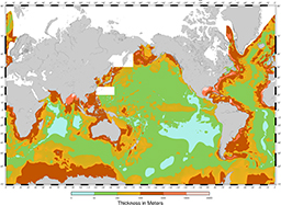
Total sediment thickness of the World’s Oceans & Marginal Seas, version 2

Sedthickv2 256x188This update replaces the original Total Sediment Thickness of the World’s Oceans & Marginal Seas (Divins, 2003).

Citation
Whittaker, J. M., Goncharov, A., Williams, S. E., Müller, R. D., & Leitchenkov, G. (2013). Global sediment thickness data set updated for the Australian‐Antarctic Southern Ocean. Geochemistry, Geophysics, Geosystems, 14(8), 3297-3305. doi: 10.1002/ggge.20181.

Summary
NGDC’s global ocean sediment thickness grid (Divins, 2003) has been updated for the Australian-Antarctic region (60°-155°E, 30°-70°S). New seismic reflection and refraction data have been used to add detail to the conjugate Australian and Antarctic margins and intervening ocean floor where previously regional sediment thickness patterns were poorly known.  … Read more…

Share

The IntraCONtinental basinS (ICONS) atlas

The ICONS atlas is a collection of basin data for over 240 intracontinental sedimentary basins, displaying crustal structure data, computed extension factors and tectonic subsidence grids and derivatives thereof as well as the dynamic topography evolution of a given basin. The atlas was compiled by Christian Heine as part of his PhD project investigating the formation and … Read more…