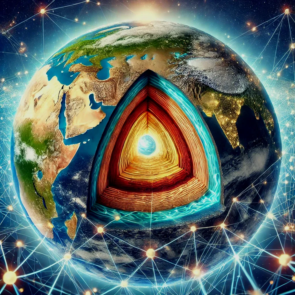
Leveraging Machine Learning and Geophysical Data for Automated Detection of Interior Structures of Cratons

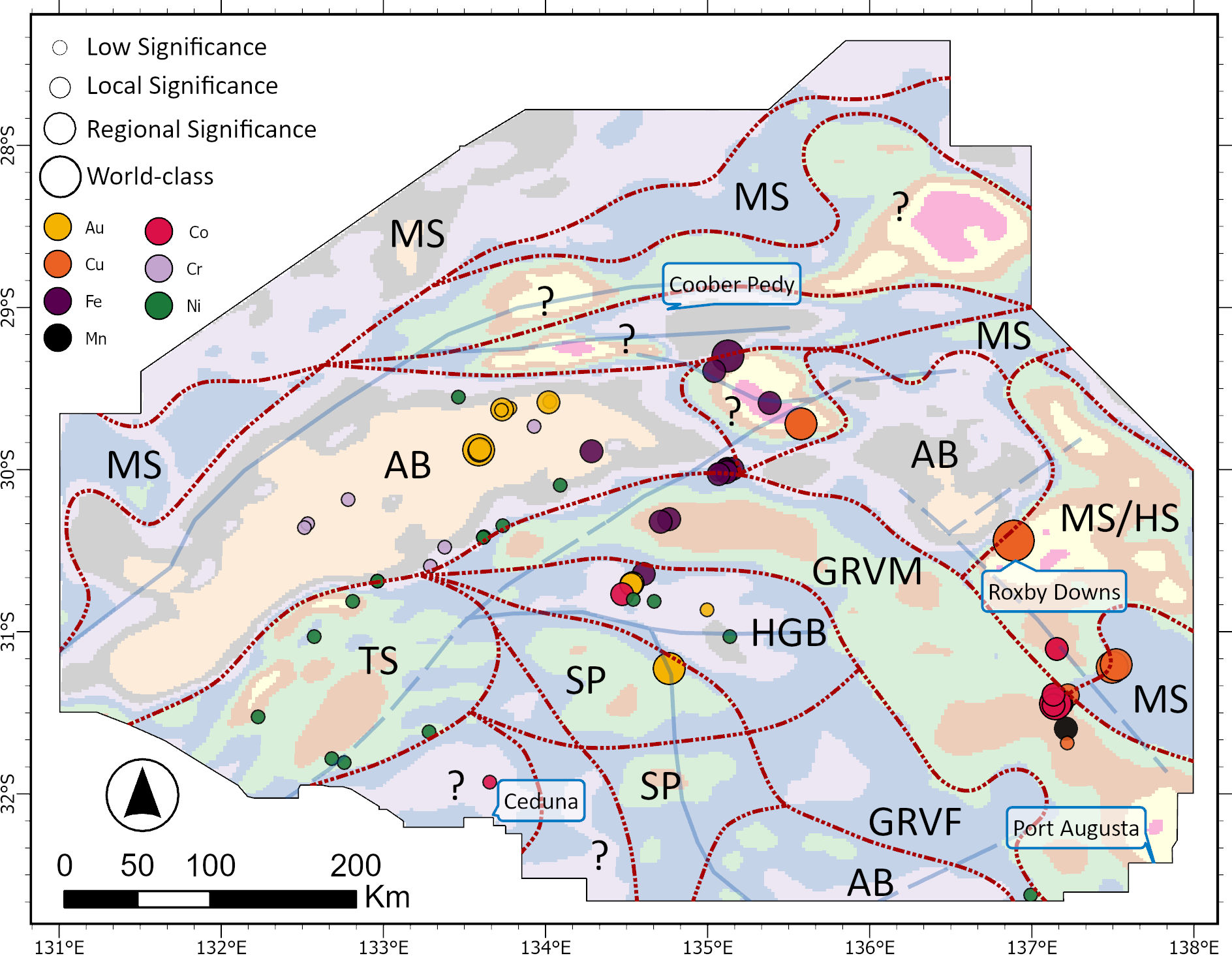
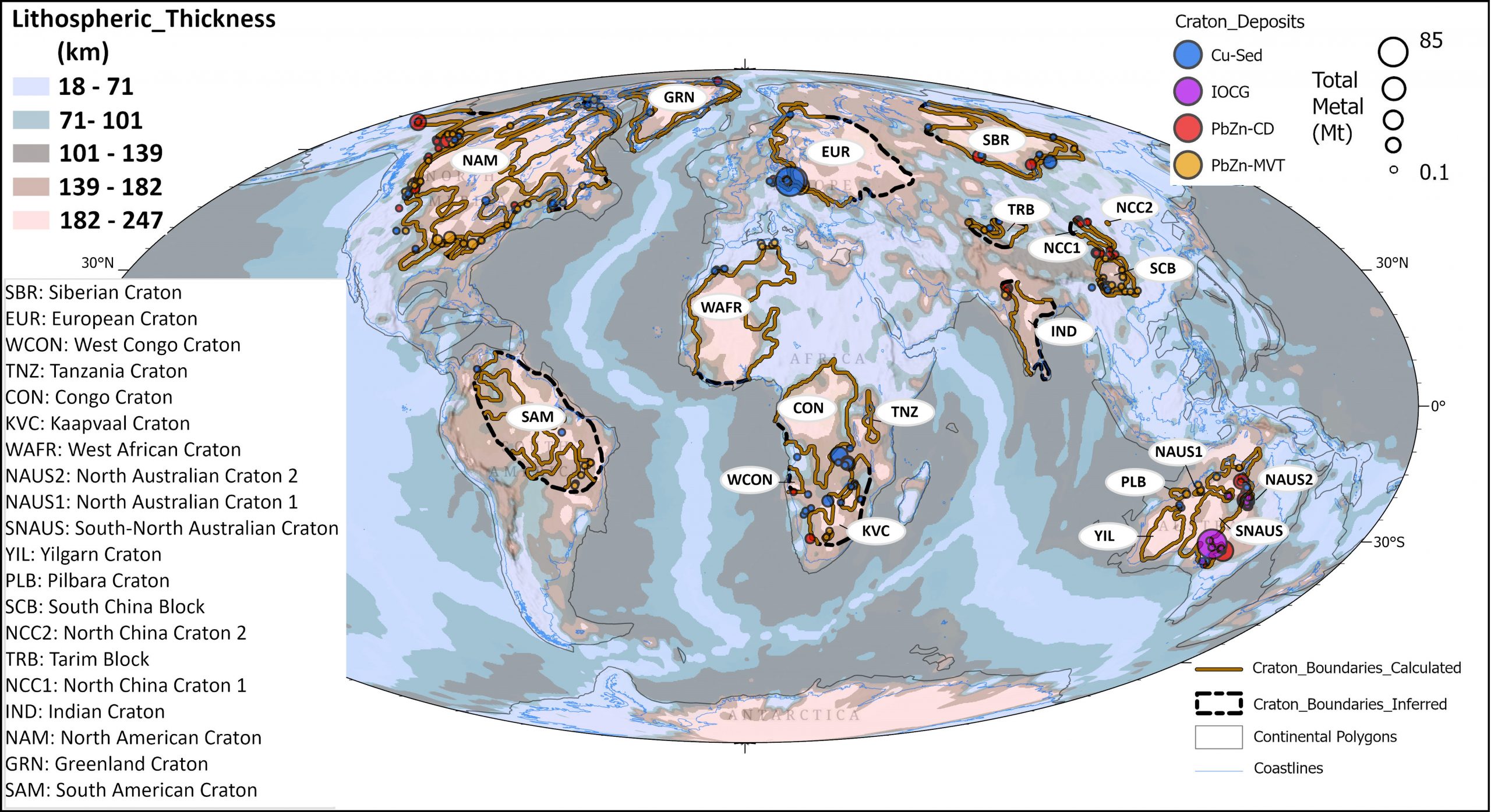
The internal structures and discontinuities of cratons hold considerable economic value due to their tendency for reactivation and different horizontal stress, serving as conduits for fluid flow and mineral deposition over time. Detecting these structures at various depths is critical for accurately mapping prospective zones of metallic mineralisation. This study demonstrates the effectiveness of integrating … Read more…

Collaboration between artificial intelligence and Earth science communities for mutual benefit

A recent analysis concluded that Australia is at risk of losing its world-leading advantage in critical and rare minerals if it doesn’t sufficiently leverage artificial intelligence (AI). A large international coalition of Earth scientists and AI researchers is now advocating for stronger bidirectional development and impact between AI and Earth science in a new comment … Read more…

Net Zero Institute White Paper on Critical Minerals and Materials released

The University of Sydney’s Net Zero Institute has just released their White Paper on Critical Minerals & Materials. It represents a massive collaborative effort of over 50 colleagues from the University and international partners. The EarthByte Group has made a contribution to it with an outline of AI-powered mineral prospectivity mapping, particularly applied to copper … Read more…

PLATO – PLAte Tectonics and Ore deposits

Project PLATO is an ARC Linkage project as a collaboration between the EarthByte Group and Lithodat. CIs, PIs and AIs include Dietmar Müller (Usyd) Maria Seton (Usyd) Sabin Zahirovic (Usyd) Sara Polanco (Usyd) Brent McInnes (Curtin Univ.) Fabian Kohlmann (Lithodat) In addition, Dr Ehsan Farahbakhsh is a research fellow and Elnaz Heidari is a PhD student … Read more…

Spatio-temporal copper prospectivity in the American Cordillera predicted by positive-unlabeled machine learning

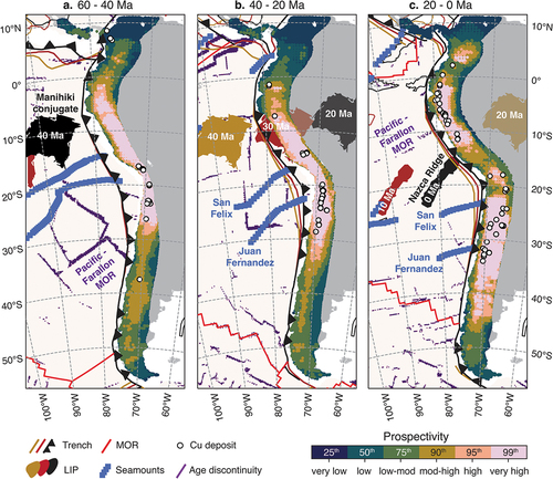
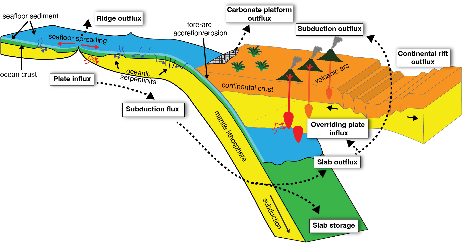
Porphyry copper deposits contain the majority of the world’s discovered mineable reserves of copper. While these deposits are known to form in magmatic arcs along subduction zones, the precise contributions of different factors in the subducting and overriding plates to this process are not well constrained, making predictive prospectivity mapping difficult. Empirical machine learning-based approaches … Read more…

Geoscience Frontiers: Earth’s tectonic and plate boundary evolution over 1.8 billion years

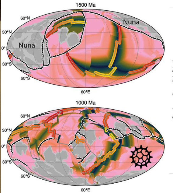
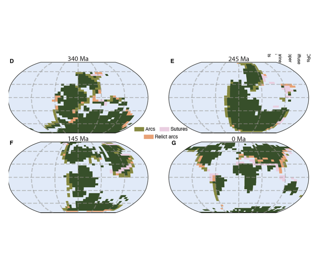
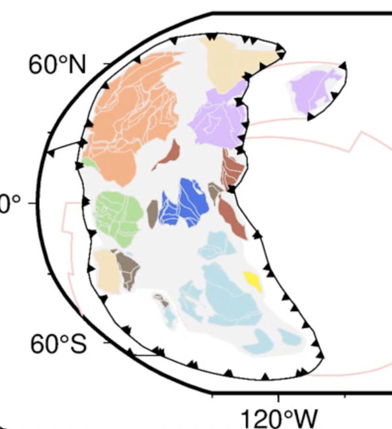
Understanding the intricate relationships between the solid Earth and its surface systems in deep time necessitates comprehensive full-plate tectonic reconstructions that include evolving plate boundaries and oceanic plates. In particular, a tectonic reconstruction that spans multiple supercontinent cycles is important to understand the long-term evolution of Earth’s interior, surface environments and mineral resources. Here, we present a new full-plate tectonic reconstruction from 1.8 Ga to present that combines and refines three published models: one full-plate tectonic model spanning 1 Ga to present and two continental-drift models focused on the late Paleoproterozoic to Mesoproterozoic eras. Our model is constrained by geological and geophysical data, and presented as a relative plate motion model in a paleomagnetic reference frame. The model encompasses three supercontinents, Nuna (Columbia), Rodinia, and Gondwana/Pangea, and more than two complete supercontinent cycles, covering ~40% of the Earth’s history. Our refinements to the base models are focused on times before 1.0 Ga, with minor changes for the Neoproterozoic. For times between 1.8 Ga and 1.0 Ga, the root mean square speeds for all plates generally range between 4 cm/yr and 7 cm/yr (despite short-term fast motion around 1.1 Ga), which are kinematically consistent with post-Pangean plate tectonic constraints. The time span of the existence of Nuna is updated to between 1.6 Ga (1.65 Ga in the base model) and 1.46 Ga based on geological and paleomagnetic data. We follow the base models to leave Amazonia/West Africa separate from Nuna (as well as Western Australia, which only collides with the remnants of Nuna after initial break-up), and South China/India separate from Rodinia. Contrary to the concept of a “boring billion”, our model reveals a dynamic geological history between 1.8 Ga and 0.8 Ga, characterized by supercontinent assembly and breakup, and continuous accretion events. The model is publicly accessible, providing a framework for future refinements and facilitating deep time studies of Earth’s system. We suggest that the model can serve as a valuable working hypothesis, laying the groundwork for future hypothesis testing.

Click on the image to watch the video on youtube

Cao, X., Collins, A.S., Pisarevsky, S., Flament, N., Li, S., Hasterok, D. and Müller, R.D., 2024. Earth’s tectonic and plate boundary evolution over 1.8 billion years. Geoscience Frontiers, p.101922.

Download the plate model from zenodoRead more…

Share

Applied Geochemistry: Multivariate statistical analysis and bespoke deviation network modeling for geochemical anomaly detection of rare earth elements

Rare earth elements (REEs), a significant subset of critical minerals, play an indispensable role in modern society and are regarded as “industrial vitamins,” making them crucial for global sustainability. Geochemical survey data proves highly effective in delineating metallic mineral prospects. Separating geochemical anomalies associated with specific types of mineralization from the background reflecting geological processes … Read more…

Geology: Submarine volcanism along shallow ridges did not drive Cryogenian cap carbonate formation – Reply

In their comment, Gernon et al. (2024) maintain that their “shallow ridge hypothesis” for cap carbonate formation (Gernon et al., 2016) is valid, disregarding abundant evidence to the contrary. Here we address four flaws in their argument. First, their hypothesis (Gernon et al., 2016) is based on a “proof by example” argument—a logical fallacy. Evidence … Read more…

Keynote Talk at Exploration in the House: Critical minerals – prospectivity mapping using generative AI

In the recent Exploration in the House event at Parliament House in Sydney Dietmar provided an overview of the use of generative AI for assessing copper, nickel and cobalt prospectivity in the Lachlan fold belt, based on the Honours thesis of Nathan Wake, and work by Ehsan Farahbakhsh and Vera Nolte-Wilson. The event also featured … Read more…
Exploration in the House: AI, new data, new exploration futures

EXPLORATION IN THE HOUSE – NEW DATA, NEW EXPLORATION FUTURES The half-day event on Friday 10 May will feature a keynote presentation on the applications of artificial intelligence-driven data processing in the search for critical minerals. Join Mining, Exploration and Geoscience for Exploration in the House – New data, new exploration futures at the NSW … Read more…
Space News: Surprising connections between Earth and Mars

Space Connect reported how EarthByters discovered that Earth’s interactions with Mars can drive deep sea circulation here on Earth. The podcast covers how geological records of the deep sea were used to discover a link between the orbits of the two planets and past global warming patterns, talking through the research and their collaboration with Sorbonne … Read more…
Quirks and Quarks: EarthByte on Canadian National Radio with a story on Earth, Mars and ocean mixing

Mars has more influence on Earth than non-astrologers might have thought. Mars is, on average, about 225 million kilometres from Earth, which would suggest that it has little impact on our planet. Which is true, but as they say, a little goes a long way. In our recent paper in Nature Communications, we studied the history of deep … Read more…

GPlates 2.5 software and data sets

GPlates Title Logo


GPlates is a free desktop software for the interactive visualisation of plate-tectonics. The compilation and documentation of GPlates 2.5 data was primarily funded by AuScope National Collaborative Research Infrastructure (NCRIS).

GPlates is developed by the EarthByte Group (part of AuScope NCRIS) at the University of Sydney and the Division of Geological and Planetary Sciences (GPS) at California Institute of Technology (CalTech). … Read more…

Share

Mars attracts: how Earth’s planetary interactions drive deep-sea circulation

12 March 2024, The University of Sydney Media Release Giant whirlpools in warming oceans could mitigate Gulf Stream stagnation Geoscientists at Sydney and Sorbonne have identified a 2.4-million-year cycle in the geological record that show the energy of deep-sea currents wax and wane as oceans cool and warm. Earth’s distance to Mars varies between 55 … Read more…

Nature Communications: Deep-sea hiatus record reveals orbital pacing by 2.4 Myr eccentricity grand cycles

Astronomical forcing of Earth’s climate is embedded in the rhythms of stratigraphic records, most famously as short-period (10^4–10^5 year) Milankovitch cycles. Astronomical grand cycles with periods of millions of years also modulate climate variability but have been detected in relatively few proxy records. Here, we apply spectral analysis to a dataset of Cenozoic deep-sea hiatuses … Read more…

AuScope News: EarthByters unveil Ice Age secrets

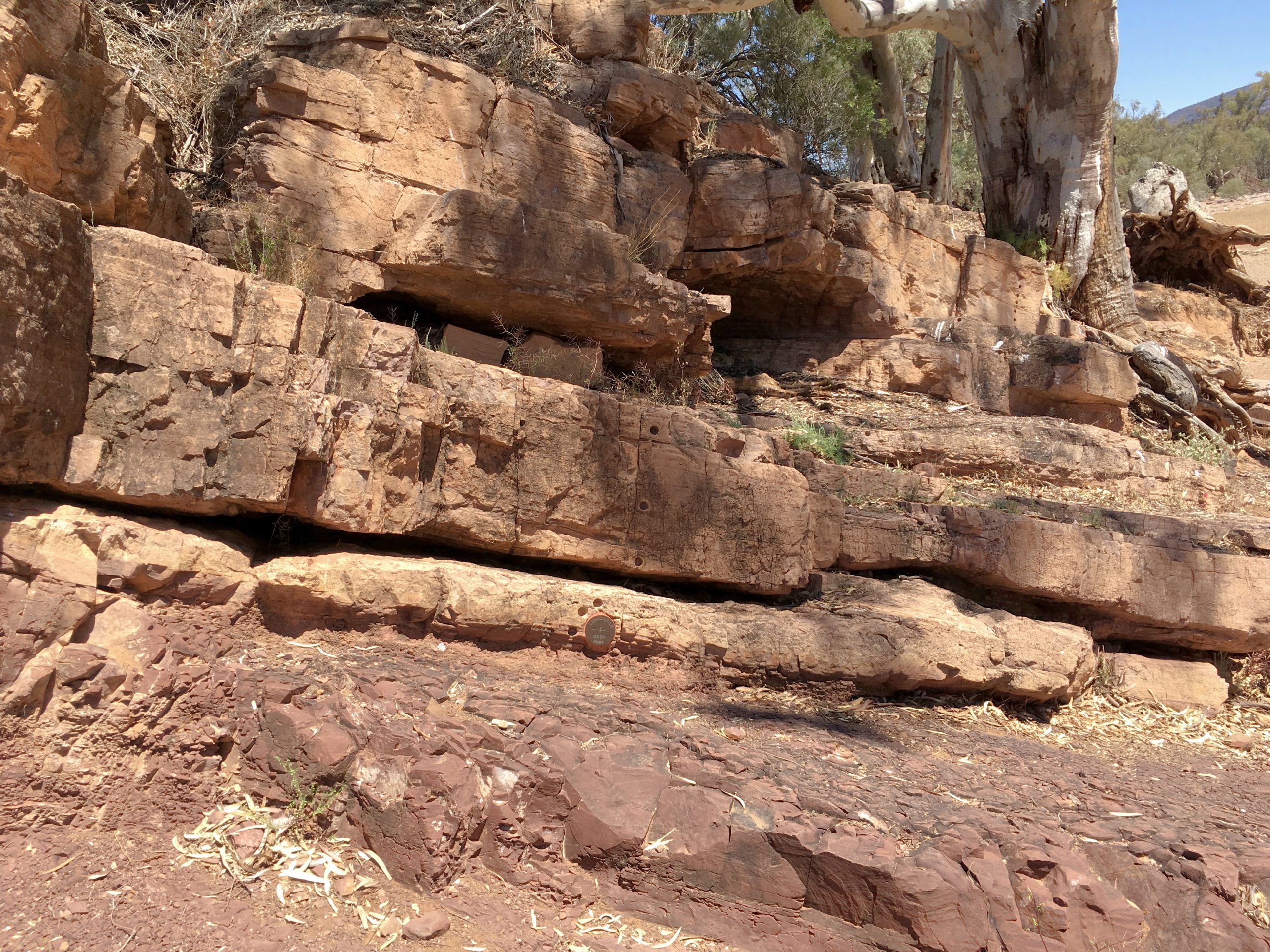
Notebook resting on an Ice Age or the transition from the Tonian Skillogallee and Myrtle Springs Formations to the overlying Cryogenian Sturt Formation (Sturt Glaciation, marked by the notebook) in the Willouran Ranges, Adnyamathanha Country, South Australia. Image: Alan Collins ARC Future Fellow Dr Adriana Dutkiewicz from the EarthByte Group and colleagues have used NCRIS … Read more…

New data set for refined boundaries between continental and ocean crust released

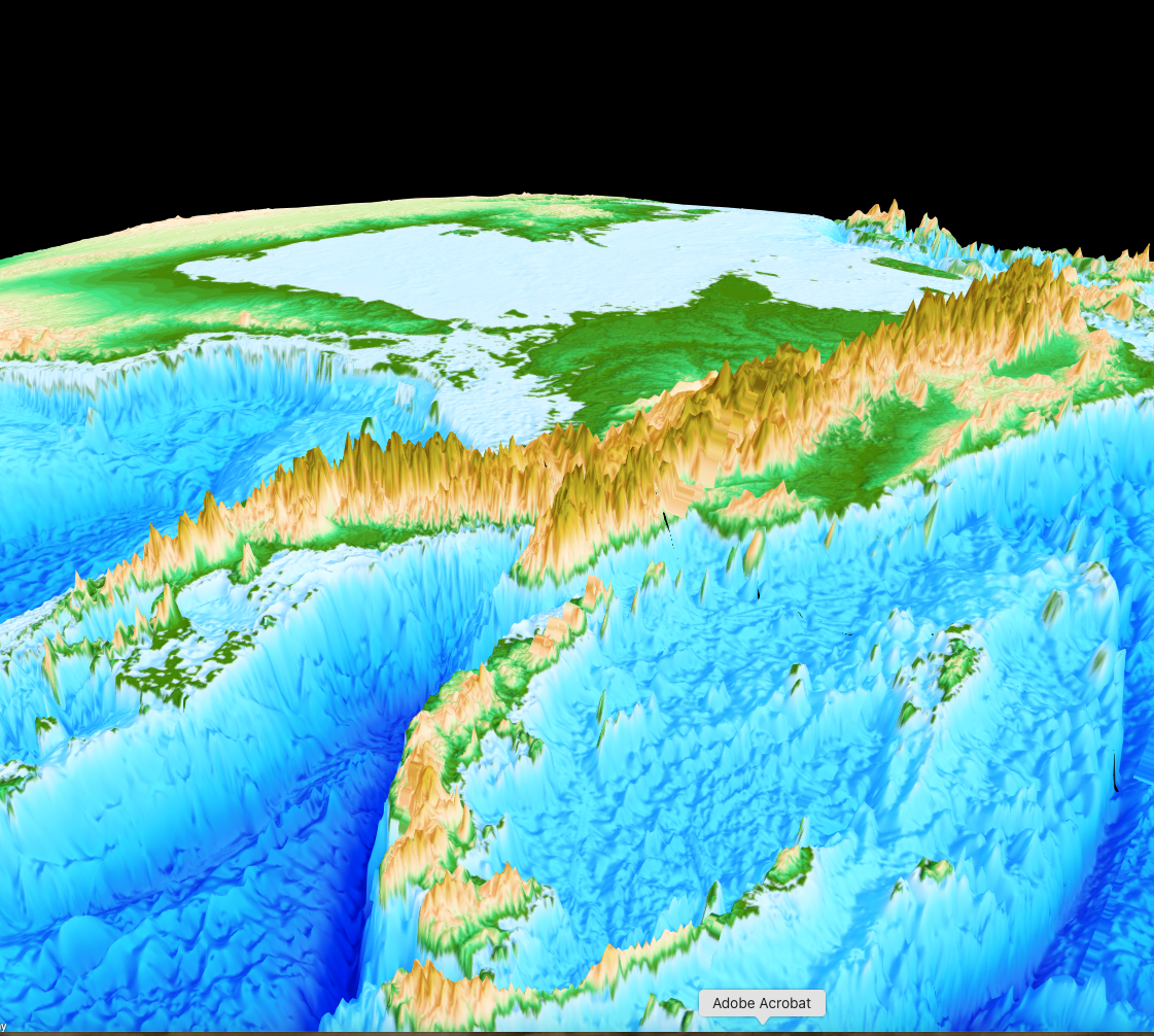
Earth’s topography and bathymetry with revised boundaries between continental and ocean crust overlain as thin red lines. We have released a refined data set of the boundaries between continental and ocean crust (COBs). The data can be downloaded from zenodo as GPlates-compatible gpmlz and as ESRI shapefile. The COBs are based on the data set … Read more…

Geology: Submarine volcanism along shallow ridges did not drive Cryogenian cap carbonate formation

The termination of Neoproterozoic “Snowball Earth” glaciations is marked globally by laterally extensive neritic cap carbonates directly overlying glacial diamictites. The formation of these unique deposits on deglaciation calls for anomalously high CaCO3 saturation. A popular mechanism to account for the source of requisite ocean alkalinity is the shallow-ridge hypothesis, in which initial spreading ridges … Read more…

Geology: Duration of Sturtian “Snowball Earth” glaciation linked to exceptionally low mid-ocean ridge outgassing

The Sturtian ‘Snowball Earth’ glaciation (~717–661 Ma) is regarded as the most extreme interval of icehouse climate in Earth’s history. The exact trigger and sustention mechanisms for this long-lived global glaciation remain obscure. The most widely debated causes are silicate weathering of the ~718 Ma Franklin LIP, and changes in the length and degassing of … Read more…

GPlates 2.4 software and data sets

GPlates Title Logo


GPlates is a free desktop software for the interactive visualisation of plate-tectonics. The compilation and documentation of GPlates 2.4 data was primarily funded by AuScope National Collaborative Research Infrastructure (NCRIS).

GPlates is developed by the EarthByte Group (part of AuScope NCRIS) at the University of Sydney and the Division of Geological and Planetary Sciences (GPS) at California Institute of Technology (CalTech). … Read more…

Share

EOS: Shifts in Tectonic Plates Change Biodiversity

For the past 250 million years, species have diversified and died out while Earth’s tectonic plate movements and sea level changes have operated in the background. They’re linked, according to new research that found that processes altering the lithosphere affect ocean levels and, in turn, the availability of shallow marine environments in which life thrives. “Why we … Read more…

Scientific Reports: A geospatial platform for the tectonic interpretation of low‐temperature thermochronology Big Data

Low‐temperature thermochronology is a powerful tool for constraining the thermal evolution of rocks and minerals in relation to a breadth of tectonic, geodynamic, landscape evolution, and natural resource formation processes through deep time. However, complexities inherent to these analytical techniques can make interpreting the significance of results challenging, requiring them to be placed in their … Read more…

Scientific Reports: Kimberlite eruptions driven by slab flux and subduction angle

Kimberlites are sourced from thermochemical upwellings which can transport diamonds to the surface of the crust. The majority of kimberlites preserved at the Earth’s surface erupted between 250 and 50 million years ago, and have been attributed to changes in plate velocity or mantle plumes. However, these mechanisms fail to explain the presence of strong … Read more…

Scientists discover 36-million-year geological cycle that drives biodiversity

11 July 2023 Tectonic changes alter sea levels that can create breeding grounds for life Movement in the Earth’s tectonic plates indirectly triggers bursts of biodiversity in 36-million-year cycles by forcing sea levels to rise and fall, new research has shown. Dinosaur Stampede exhibit at Dinosaur Canyon, located in Queensland’s Winton Formation which was formed … Read more…

PNAS: Earth’s interior dynamics drive marine fossil diversity cycles of tens of millions of years

The fossil record reveals that biotic diversity has fluctuated quasi-cyclically through geological time. However, the causal mechanisms of biotic diversity cycles remain unexplained. Here, we highlight a common, correlatable 36 ± 1 Myr (million years) cycle in the diversity of marine genera as well as in tectonic, sea-level, and macrostratigraphic data over the past 250 … Read more…

Deep time spatio-temporal data analysis using pyGPlates with PlateTectonicTools and GPlately

Plate Models

PyGPlates is an open-source Python library to visualize and edit plate tectonic reconstructions created using GPlates. The Python API affords a greater level of flexibility than GPlates to interrogate plate reconstructions and integrate with other Python workflows. GPlately was created to accelerate spatio-temporal data analysis leveraging pyGPlates and PlateTectonicTools within a simplified Python interface. This … Read more…

Tectonics: Modeling Lithospheric Thickness Along the Conjugate South Atlantic Passive Margins Implies Asymmetric Rift Initiation

The lithospheric architecture of passive margins is crucial for understanding the tectonic processes that caused the breakup of Gondwana. We highlight the evolution of the South Atlantic passive margins by a simple thermal lithosphere-asthenosphere boundary (LAB) model based on onset and cessation of rifting, crustal thickness, and stretching factors. We simulate lithospheric thinning and select … Read more…

GPlately1.0 released

GPlately

We have just released GPlately1.0 as a conda package. GPlately was created to accelerate spatio-temporal data analysis leveraging pyGPlates and PlateTectonicTools within a simplified Python interface. GPlately is a python package that enables the reconstruction of data through deep geologic time (points, lines, polygons and rasters), the interrogation of plate kinematic information (plate velocities, rates of subduction … Read more…

Clarke Memorial Lecture: Reconstructing ancient oceans, sea-level fluctuations, the deep carbon cycle and biodiversity

The Royal Society of NSW Clarke Memorial Open Lecture on Wednesday 5 April 2023 will be delivered by Dietmar Müller on “Reconstructing ancient oceans, sea-level fluctuations, the deep carbon cycle and biodiversity”. Venue: Gallery Room, State Library of NSW, Shakespeare Place Abstract This presentation is a journey through geological time, reconstructing ancient oceans that have … Read more…

Evolution of Mantle Plumes and Lower Mantle Structure in Numerical Models Using Tectonic Reconstructions as Boundary Conditions

We evaluate four mantle convection models that use tectonic reconstructions to specify kinematic boundary conditions to explore the development of the lower mantle large low shear velocity provinces (LLSVP) structures and their relationship with mantle plumes. Evolution of mantle plumes in our spherical models is broadly consistent with observations including the number of plumes generated … Read more…