How supercontinents and superoceans affect seafloor roughness

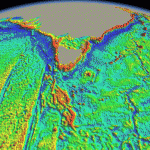
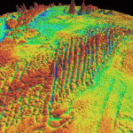
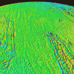
Tasman Sea grav SW Indian grav Pacific grav

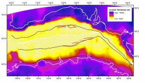
Seafloor roughness varies considerably across the world’s ocean basins and is fundamental to controlling the circulation and mixing of heat in the ocean and dissipating eddy kinetic energy. Models derived from analyses of active mid-ocean ridges suggest that ocean floor roughness depends on seafloor spreading rates, with rougher basement forming below a half-spreading rate threshold of 30-35 mm/yr, as well as on the local interaction of mid-ocean ridges with mantle plumes or cold-spots.
Read more…

Share

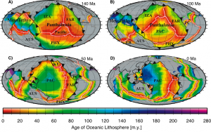
Age and Bathymetry of the World’s Ocean Crust for the last 140 million years

Muller etal Figure1Reconstructing vanished oceans
We establish the locations and geometry of mid ocean ridges through time on the basis of marine magnetic anomaly identifications, geological information such as paleomagnetic data from terranes and microcontinents, especially in the Tethys Ocean, mid-oceanic ridge subduction events and the rules of plate tectonics. Based on a global set of tectonic plate rotations we construct a set of refined seafloor isochrons following the interpolation technique outlined by Müller et al. (1997; 2008) but including a multitude of additional data. … Read more…

Share

Global subduction and back-arc basin grids and data

Please Note: These age grids are now outdated. Please see the agegrids available from the Müller et al. 2013 study on Ocean Chemistry at the Seawater chemistry driven by supercontinent assembly, break-up and dispersal resource page.

Subduction image 1Downloads
Download global subduction age grid images via FTP here – tgz file
Download global subduction parameter dataset via FTP here – tgz file
Read more…

Share

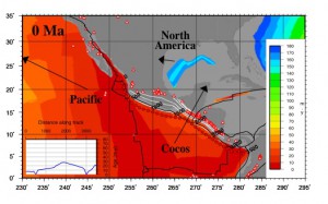
Integrating global multidimensional datasets to underpin subduction process modelling during the past 60 million years

Project Report
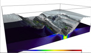
Understanding the initiation and processes governing subduction remains one of the greatest challenges in geodynamics. Subduction processes affect every aspect of the Earth system, from its control on the thermal and chemical state of the mantle, to its recycling of oceanic lithosphere, sediments, water and volatiles, to its affect on the atmosphere, hydrosphere, biosphere and solid Earth through earthquakes and volcanic eruptions. Moreover, subduction is generally agreed to be one of the primary driving forces of plate tectonics and mantle convection through slab pull and the addition of raw materials into the mantle. … Read more…

Share

Constructing a tectonic framework for Ocean Drilling at high latitudes

Project Summary
Currently a major Ocean Drilling Program (ODP) campaign south of Australia is being carried out, comprising nine drilling legs. We propose to create a tectonic and paleogeographic framework for interpreting, modelling and synthesising these data. A joint analysis of Arctic and Antarctic regions will bring together a group of researchers from the Universities of Ottawa/Canada, California at San Diego/USA and Sydney to integrate data and models for the evolution of polar ocean basins and margins. The project will strengthen our ties with centres of excellence in polar geoscience and help to maximise the return for Australia’s investment in ODP.  … Read more…

Share

Seafloor spreading around Australia

(a) Abstract
The Australian Plate has undergone major changes in plate boundary geometry and relative plate velocities since the breakup of Gondwanaland. We illustrate the history of seafloor spreading around Australia by reconstructing gridded ocean floor ages and plate boundary configurations in a fixed Australian reference frame. In the Argo Abyssal Plain, seafloor spreading started at M25 dated as 154.3 Ma Late Jurassic (Oxfordian). The onset of seafloor spreading west of Australia at ~136 Ma marks the breakup between Greater India and Australia. Roughly at the same time, long-lived subduction east of Australia ceased, probably due to subduction of the Phoenix-Pacific spreading ridge, changing this plate boundary to a transform margin. … Read more…

Share

Numerical Modeling of Archean Tectonic Regimes by 2-Dimensional Finite Element Code

Project Summary
Many lines of evidence suggest that heat loss from the earth should have been significantly greater in the Archean. The presence of high temperature komatiites, greater radiogenic heat production and heat from the secular cooling of the earth all imply higher mantle temperatures in the Archean. However, these lines of evidence are difficult to reconcile with Archean metamorphic PT data, diamond thermobarometry, mantle xenoliths in kimberlites, the ominous lack of minimum melting granites and estimates for crustal thickness which all suggest that geothermal gradients in the Archean, at least on the continents, were not very different from today. This paradox presents problems for reconstructing Archean tectonic processes and environments.  … Read more…

Share

Seafloor imaging east and south of Australia

Project Summary
Data from three recent cruises on N.O. L’Atalante are used in collaboration with AGSO to use backscatter and bathymetry data for seafloor classification, and to reconstruct the tectonic and sedimentary history of selected areas, also based on 3.5 kHz, seismic reflection, gravity and magnetic data.

Sponsors
Australian Geological Survey Organization
Environment Australia  … Read more…

Share

The Mid-Cretaceous seafloor spreading pulse: fact or fiction?

Project Summary
A major debate in Geoscience is centred on the hypothesis that a massive pulse of rapid seafloor spreading occurred during the mid-Cretaceous (~120-80 Ma). It has been suggested that such a pulse caused prolonged magnetic field stability, large igneous provinces, a sea-level highstand, variations in atmospheric CO2 and anoxia, but doubts have been raised about its existence. We propose to test this hypothesis by creating complete palaeo-seafloor age grids for the last 130 m.y. They will serve as input for 3-D spherical convection models, whose output will be groundtruthed by plate kinematics, results from mantle tomography and by the uplift-subsidence history of cratons.  … Read more…

Share