ICONS atlas: AFR - Karoo Basin

Regional basin list

To view the data for individual basins, select a basin from the dropdown menu below or click the basin name in the overview table. This will open a separate page with detailed maps.

Click here to return to the regional overview page

Overview

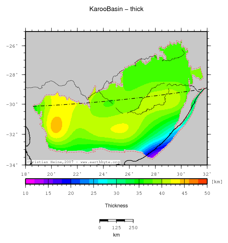
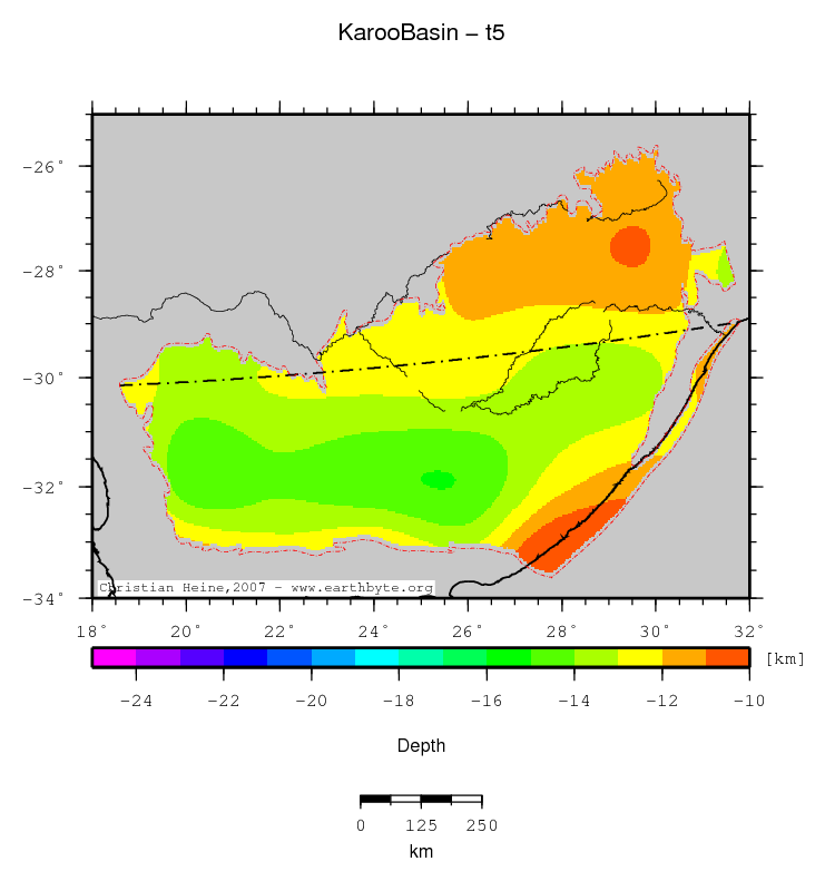
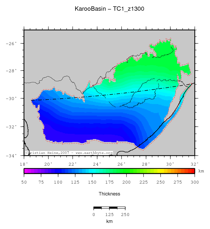
This page bundles the available data for the Karoo Basin in the Africa. The images are hyperlinks and will open up a separate window with a high resolution PDF image of the map.
The basin data is derived from a lower resolution grid which has been upsampled using GMT. This could have introduced an accuracy which is beyond the original data resolution.

Select data to display:

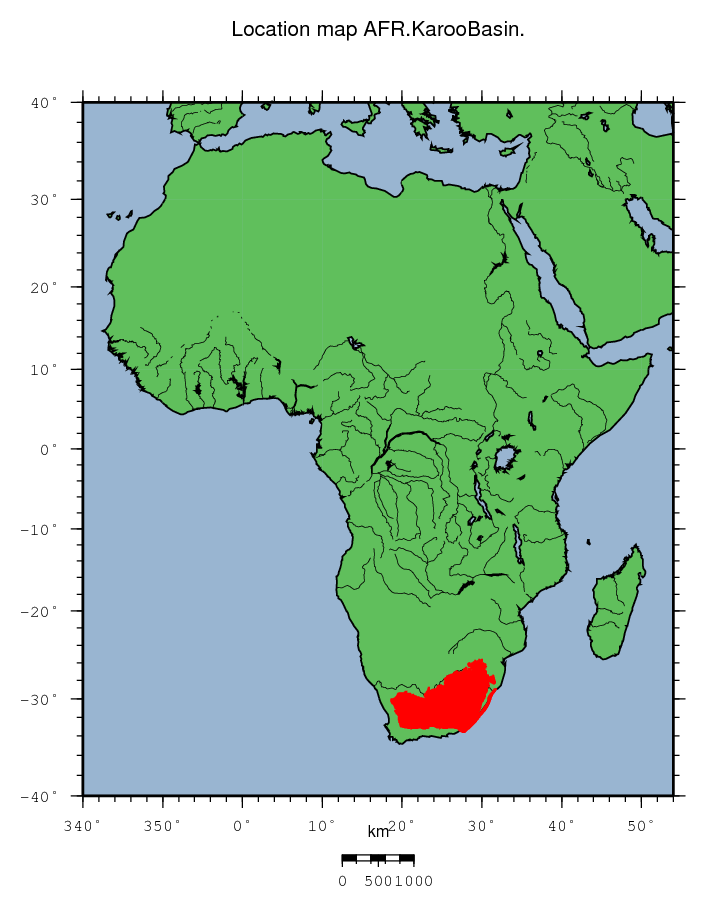
Karoo Basin location map
Basin name Karoo Basin
Region code AFR
Basin ID 7390
No. of rings 1
Basin size [km²] 595638.7
Plate location/code compress foreland/CMF
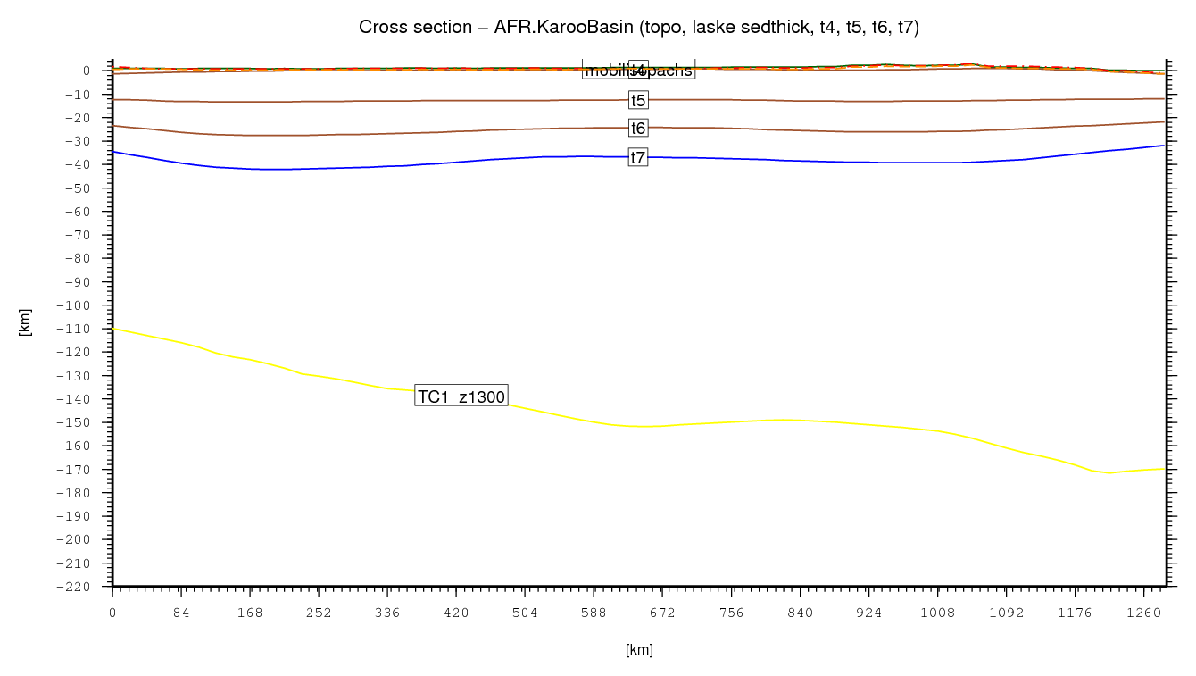
Basin cross section

The basin cross section is automatically generated using the available crustal structure data sets. Sometimes the data labels are not plotted correctly, depending on the length of the section.

The location of the profile is indicated in all maps as dashed-dotted thin black line. For the endpoints of the profile, the two points of a given polygon located farthest away from each other were computed.

Karoo Basin cross section
↑ back to the top
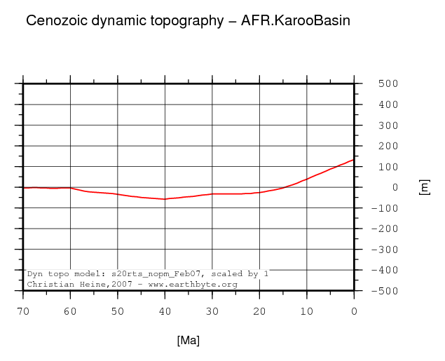
Dynamic topography evolution for basin centroid
Karoo Basin dynamic topography through time

The dynamic topography history for the basin is derived by tracking the basin centroid. The paleo-location for this point is computed using the EarthByte plate kinematic framework rotating the position back in time.

The dynamic topography model is derived from the S20RTS seismic tomography model (Ritsema et al., 99) by converting seismic velocites to density anomalies using an empirical scaling factor of 0.25. The density anomalies are then advected back in time to compute mantle flow with plate motions superimposed (using the EarthByte plate rotation framework) as surface boundary conditions. The dynamic topography is then derived from the computed density distribution using a free upper boundary. For details regarding the methodology see the following papers:

  • B. Steinberger, H. Schmeling, and G. Marquart. Large-scale lithospheric stress field and topography induced by global mantle circulation. Earth Planet. Sci. Lett., 186:75-91, 2001.
    doi: 10.1016/S0012-821X(01)00229-1.
  • B. Steinberger. Effects of latent heat release at phase boundaries on flow in the Earth's mantle, phase boundary topography and dynamic topography at the Earth's surface. Phys. Earth Planet. Int., 164:2-20, 2007.
    doi: 10.1016/j.pepi.2007.04.021.

↑ back to the top

Observations

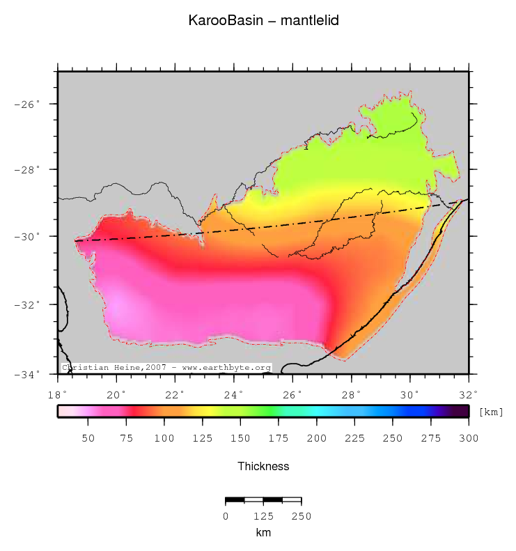
Mantle Lid thickness
Karoo Basin location map
Statistics - Mantle Lid thickness
Median 94.146
Mean 98.260
Scale 38.337
stdev 31.694
Z_min/Location 50.000/-32.0°Lat 20.0°Lon
Z_max/Location 153.266/ -27.0°Lat 29.0°Lon

For explanation to the data source or computation of this grid please follow this link. Clicking the image will open a high-res PDF of the map. Units in the statistics table are same as map units. Z_min and Z_max refer to the minima and maxima with their respective geographic locations.

↑ back to the top
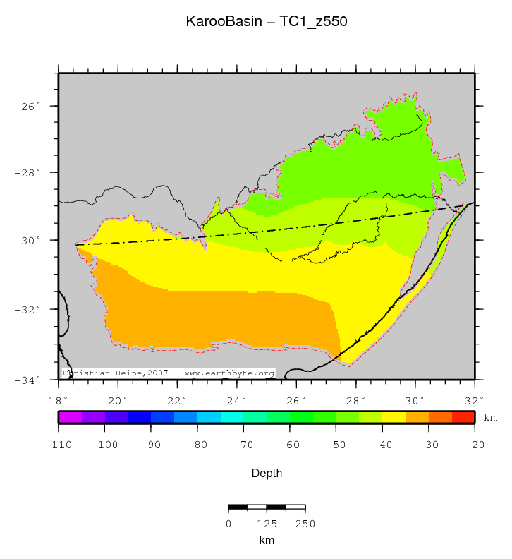
Depth of 550 deg isotherm
Karoo Basin location map
Statistics - Depth of 550 deg isotherm
Median -39.038
Mean -39.856
Scale 6.793
stdev 5.766
Z_min/Location -50.000/-25.9667°Lat 29.0°Lon
Z_max/Location -31.000/ -33.0°Lat 21.0°Lon

For explanation to the data source or computation of this grid please follow this link. Clicking the image will open a high-res PDF of the map. Units in the statistics table are same as map units. Z_min and Z_max refer to the minima and maxima with their respective geographic locations.

↑ back to the top
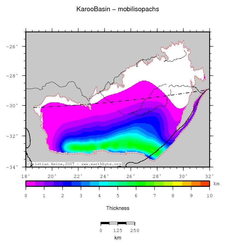
Mobil isopachs
Karoo Basin location map
Statistics - Mobil isopachs
Median 0.378
Mean 1.257
Scale 0.684
stdev 1.785
Z_min/Location -0.637/-30.1°Lat 18.6°Lon
Z_max/Location 6.534/ -32.9333°Lat 27.6333°Lon

For explanation to the data source or computation of this grid please follow this link. Clicking the image will open a high-res PDF of the map. Units in the statistics table are same as map units. Z_min and Z_max refer to the minima and maxima with their respective geographic locations.

↑ back to the top
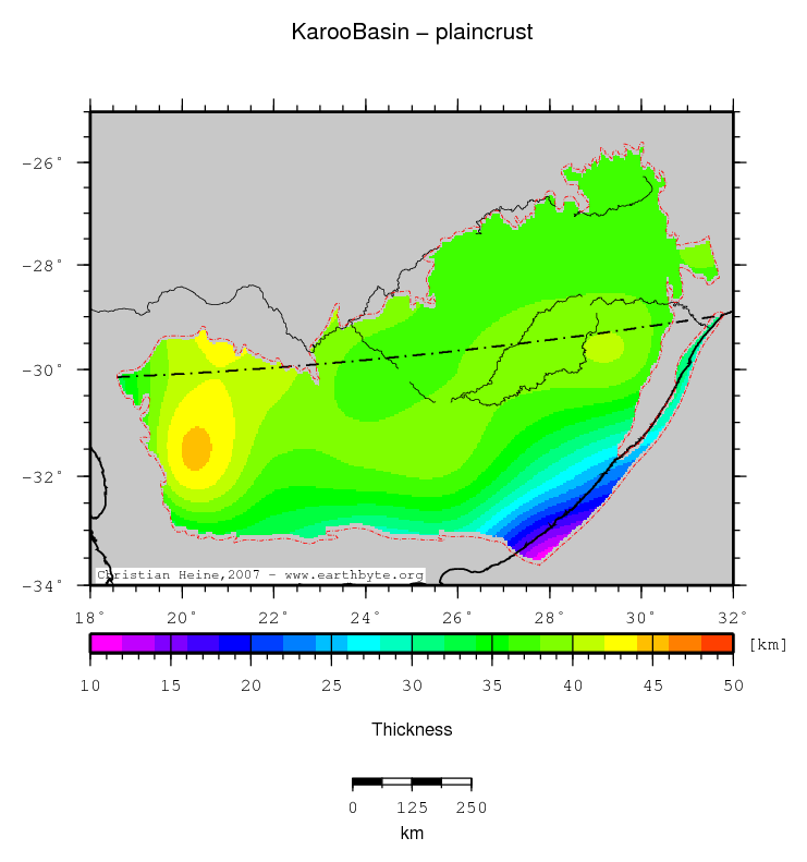
Plain crustal thickness
Karoo Basin location map
Statistics - Plain crustal thickness
Median 37.510
Mean 36.460
Scale 1.653
stdev 4.850
Z_min/Location 9.865/-33.5667°Lat 27.8667°Lon
Z_max/Location 44.594/ -31.5333°Lat 20.3°Lon

For explanation to the data source or computation of this grid please follow this link. Clicking the image will open a high-res PDF of the map. Units in the statistics table are same as map units. Z_min and Z_max refer to the minima and maxima with their respective geographic locations.

↑ back to the top
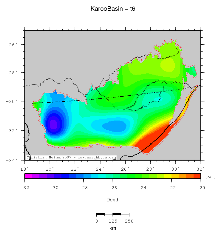
Base middle crust
Karoo Basin location map
Statistics - Base middle crust
Median -25.025
Mean -24.840
Scale 2.147
stdev 2.504
Z_min/Location -30.326/-31.6333°Lat 20.2667°Lon
Z_max/Location -11.496/ -33.5667°Lat 27.8667°Lon

For explanation to the data source or computation of this grid please follow this link. Clicking the image will open a high-res PDF of the map. Units in the statistics table are same as map units. Z_min and Z_max refer to the minima and maxima with their respective geographic locations.

↑ back to the top
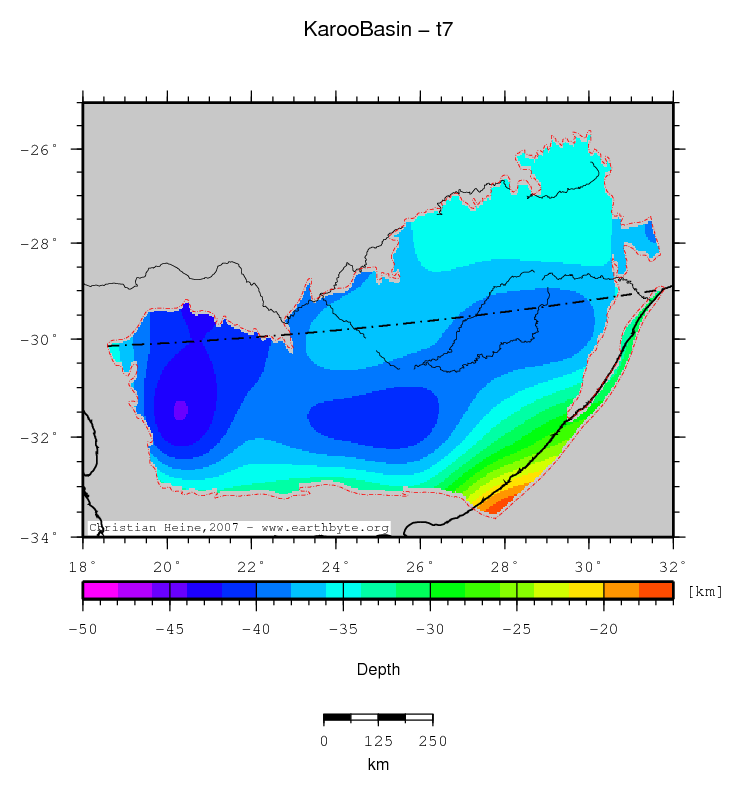
Base lower crust
Karoo Basin location map
Statistics - Base lower crust
Median -37.404
Mean -36.971
Scale 3.027
stdev 3.950
Z_min/Location -44.130/-31.4667°Lat 20.3°Lon
Z_max/Location -15.144/ -33.5667°Lat 27.8667°Lon

For explanation to the data source or computation of this grid please follow this link. Clicking the image will open a high-res PDF of the map. Units in the statistics table are same as map units. Z_min and Z_max refer to the minima and maxima with their respective geographic locations.

↑ back to the top
Total crustal thickness
Karoo Basin location map
Statistics - Total crustal thickness
Median 38.585
Mean 37.898
Scale 2.724
stdev 4.455
Z_min/Location 12.220/-33.5667°Lat 27.8667°Lon
Z_max/Location 44.834/ -31.4667°Lat 20.3333°Lon

For explanation to the data source or computation of this grid please follow this link. Clicking the image will open a high-res PDF of the map. Units in the statistics table are same as map units. Z_min and Z_max refer to the minima and maxima with their respective geographic locations.

↑ back to the top
Base upper crust
Karoo Basin location map
Statistics - Base upper crust
Median -12.918
Mean -12.820
Scale 1.214
stdev 1.157
Z_min/Location -15.046/-31.8667°Lat 25.4°Lon
Z_max/Location -8.082/ -33.5667°Lat 27.8667°Lon

For explanation to the data source or computation of this grid please follow this link. Clicking the image will open a high-res PDF of the map. Units in the statistics table are same as map units. Z_min and Z_max refer to the minima and maxima with their respective geographic locations.

↑ back to the top
Thermal lithospheric thickness
Karoo Basin location map
Statistics - Thermal lithospheric thickness
Median 130.142
Mean 136.158
Scale 36.345
stdev 31.259
Z_min/Location 90.000/-33.0°Lat 20.0°Lon
Z_max/Location 190.001/ -25.9667°Lat 29.0°Lon

For explanation to the data source or computation of this grid please follow this link. Clicking the image will open a high-res PDF of the map. Units in the statistics table are same as map units. Z_min and Z_max refer to the minima and maxima with their respective geographic locations.

↑ back to the top
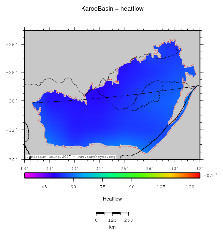
Heatflow
Karoo Basin location map
Statistics - Heatflow
Median 55.148
Mean 54.991
Scale 2.801
stdev 2.407
Z_min/Location 49.596/-28.7667°Lat 23.4°Lon
Z_max/Location 61.736/ -33.5333°Lat 27.4333°Lon

For explanation to the data source or computation of this grid please follow this link. Clicking the image will open a high-res PDF of the map. Units in the statistics table are same as map units. Z_min and Z_max refer to the minima and maxima with their respective geographic locations.

↑ back to the top
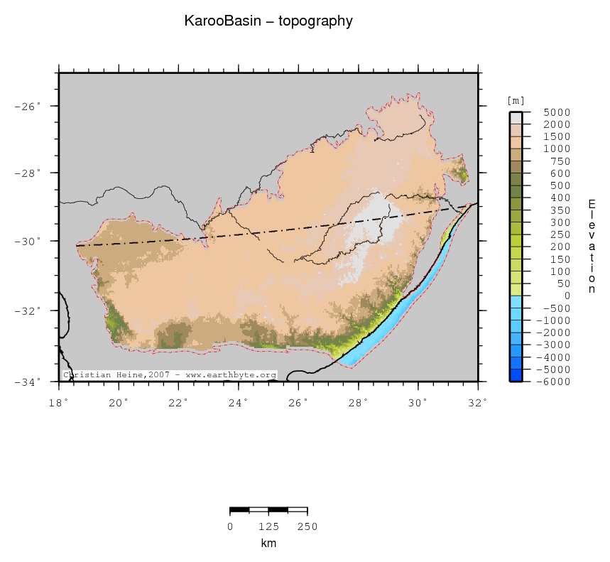
Topography (ETOPO2)
Karoo Basin location map
Statistics - Topography (ETOPO2)
Median 1264.000
Mean 1202.040
Scale 403.267
stdev 559.387
Z_min/Location -2729.000/-33.5333°Lat 27.9°Lon
Z_max/Location 3399.000/ -29.4333°Lat 29.2667°Lon

For explanation to the data source or computation of this grid please follow this link. Clicking the image will open a high-res PDF of the map. Units in the statistics table are same as map units. Z_min and Z_max refer to the minima and maxima with their respective geographic locations.

↑ back to the top
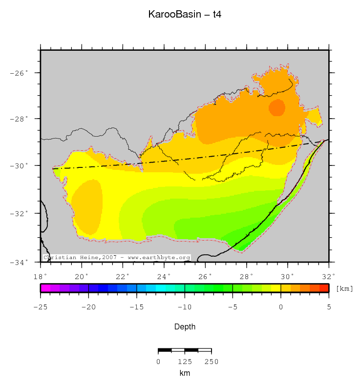
Base hard sediments
Karoo Basin location map
Statistics - Base hard sediments
Median -0.138
Mean -0.510
Scale 1.754
stdev 1.707
Z_min/Location -5.279/-33.5667°Lat 27.8667°Lon
Z_max/Location 2.055/ -27.5667°Lat 29.5°Lon

For explanation to the data source or computation of this grid please follow this link. Clicking the image will open a high-res PDF of the map. Units in the statistics table are same as map units. Z_min and Z_max refer to the minima and maxima with their respective geographic locations.

↑ back to the top
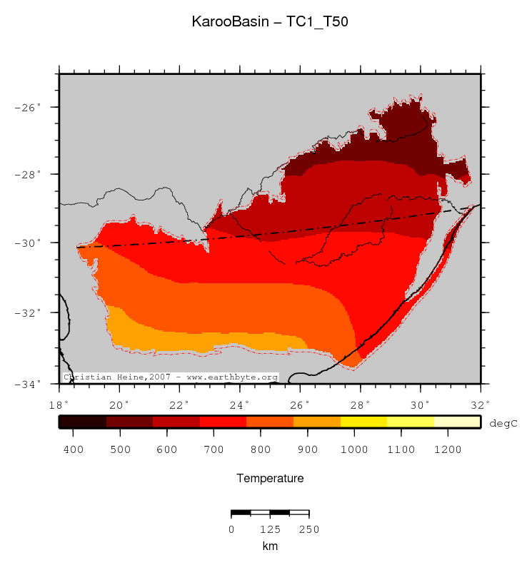
Temperature at 50km depth
Karoo Basin location map
Statistics - Temperature at 50km depth
Median 711.912
Mean 714.066
Scale 128.938
stdev 102.136
Z_min/Location 556.999/-25.9667°Lat 29.0°Lon
Z_max/Location 891.000/ -33.0°Lat 23.0°Lon

For explanation to the data source or computation of this grid please follow this link. Clicking the image will open a high-res PDF of the map. Units in the statistics table are same as map units. Z_min and Z_max refer to the minima and maxima with their respective geographic locations.

↑ back to the top
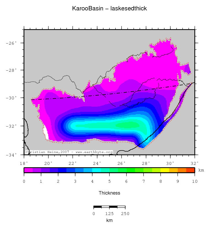
Laske sediment thickness
Karoo Basin location map
Statistics - Laske sediment thickness
Median 0.855
Mean 1.494
Scale 0.730
stdev 1.389
Z_min/Location -0.134/-32.5333°Lat 19.6°Lon
Z_max/Location 5.291/ -31.9333°Lat 26.6°Lon

For explanation to the data source or computation of this grid please follow this link. Clicking the image will open a high-res PDF of the map. Units in the statistics table are same as map units. Z_min and Z_max refer to the minima and maxima with their respective geographic locations.

↑ back to the top
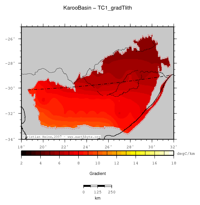
Lithospheric temperature gradient
Karoo Basin location map
Statistics - Lithospheric temperature gradient
Median 7.437
Mean 7.330
Scale 1.622
stdev 1.361
Z_min/Location 5.305/-25.9667°Lat 29.0°Lon
Z_max/Location 10.239/ -33.0°Lat 20.0°Lon

For explanation to the data source or computation of this grid please follow this link. Clicking the image will open a high-res PDF of the map. Units in the statistics table are same as map units. Z_min and Z_max refer to the minima and maxima with their respective geographic locations.

↑ back to the top

Computations

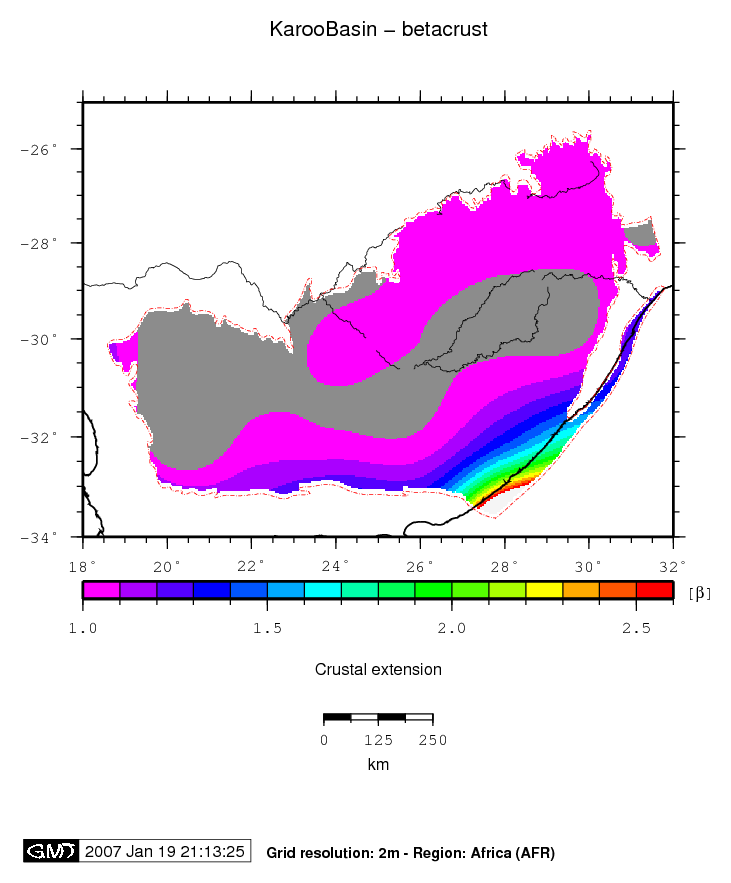
Beta (Crust)
Karoo Basin location map
Statistics - Beta (Crust)
Median 0.986
Mean 1.044
Scale 0.043
stdev 0.243
Z_min/Location 0.829/-31.5333°Lat 20.3°Lon
Z_max/Location 3.748/-33.5667°Lat 27.8667°Lon

Comments

For explanation to the data source or computation of this grid please follow this link. Clicking the image will open a high-res PDF of the map. Units in the statistics table are same as map units. Z_min and Z_max refer to the minima and maxima with their respective geographic locations.

↑ back to the top
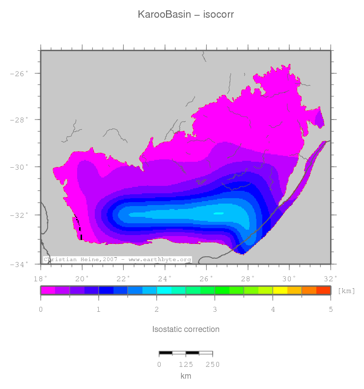
Isostatic correction
Karoo Basin location map
Statistics - Isostatic correction
Median 0.363
Mean 0.606
Scale 0.306
stdev 0.537
Z_min/Location 0.000/-32.0°Lat 19.6333°Lon
Z_max/Location 2.007/-31.9333°Lat 26.6°Lon

Comments

For explanation to the data source or computation of this grid please follow this link. Clicking the image will open a high-res PDF of the map. Units in the statistics table are same as map units. Z_min and Z_max refer to the minima and maxima with their respective geographic locations.

↑ back to the top
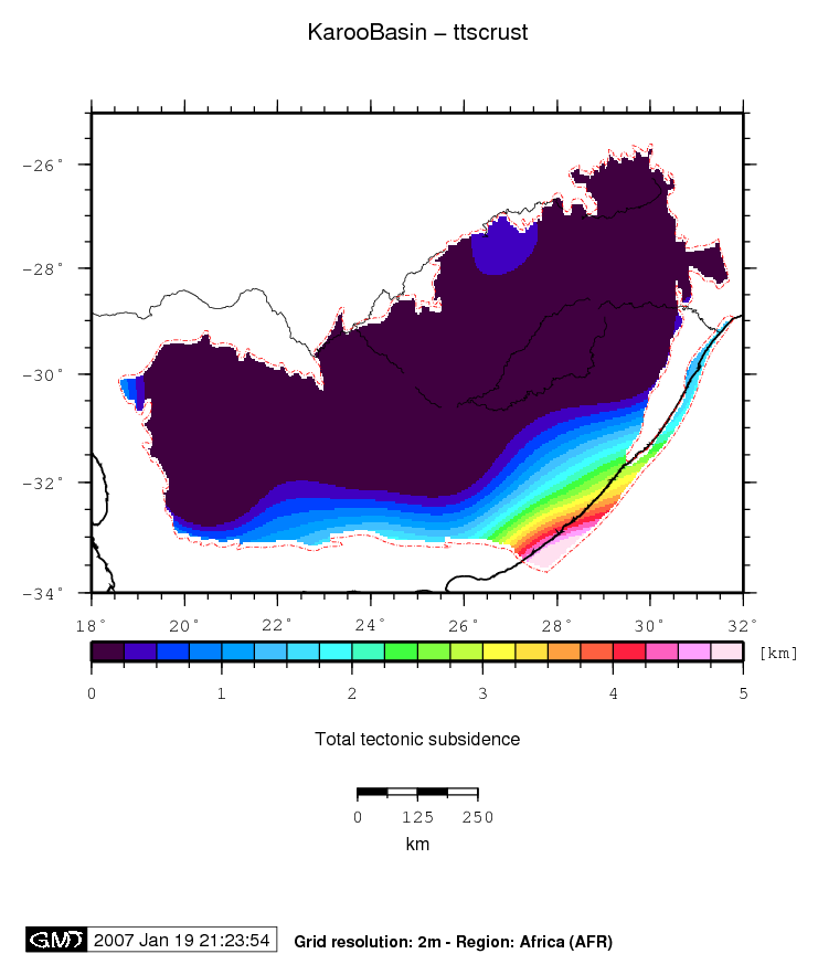
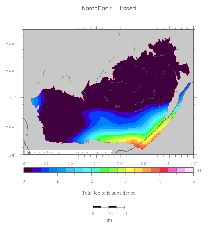
TTS (crust)
Karoo Basin location map
Statistics - TTS (crust)
Median -0.113
Mean 0.109
Scale 0.350
stdev 1.026
Z_min/Location -1.611/-31.5333°Lat 20.3°Lon
Z_max/Location 5.734/-33.5667°Lat 27.8667°Lon

Comments

For explanation to the data source or computation of this grid please follow this link. Clicking the image will open a high-res PDF of the map. Units in the statistics table are same as map units. Z_min and Z_max refer to the minima and maxima with their respective geographic locations.

↑ back to the top
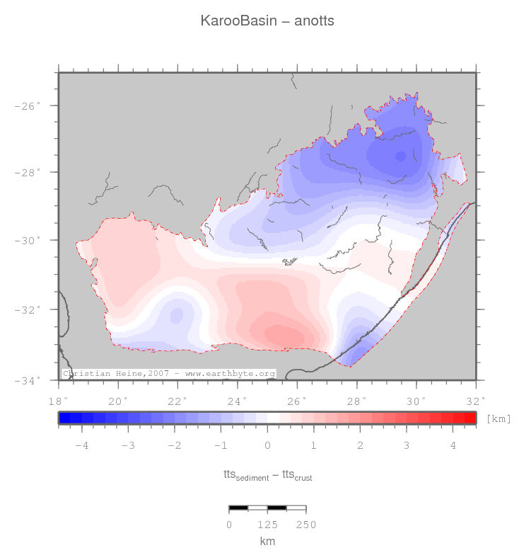
TTS (sediment)
Karoo Basin location map
Statistics - TTS (sediment)
Median -0.257
Mean -0.095
Scale 1.192
stdev 1.324
Z_min/Location -2.234/-27.5667°Lat 29.5°Lon
Z_max/Location 4.156/-33.6°Lat 27.8°Lon

Comments

For explanation to the data source or computation of this grid please follow this link. Clicking the image will open a high-res PDF of the map. Units in the statistics table are same as map units. Z_min and Z_max refer to the minima and maxima with their respective geographic locations.

↑ back to the top
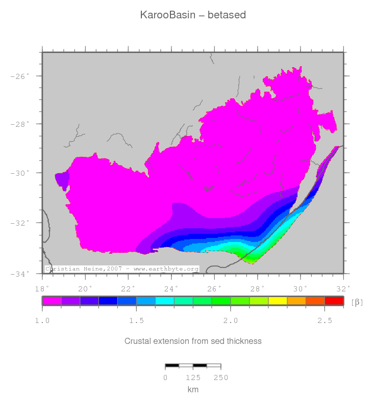
Beta (Sediment)
Karoo Basin location map
Statistics - Beta (Sediment)
Median 0.968
Mean 1.023
Scale 0.143
stdev 0.216
Z_min/Location 0.778/-27.5667°Lat 29.5°Lon
Z_max/Location 2.134/-33.6°Lat 27.8°Lon

Comments

For explanation to the data source or computation of this grid please follow this link. Clicking the image will open a high-res PDF of the map. Units in the statistics table are same as map units. Z_min and Z_max refer to the minima and maxima with their respective geographic locations.

↑ back to the top
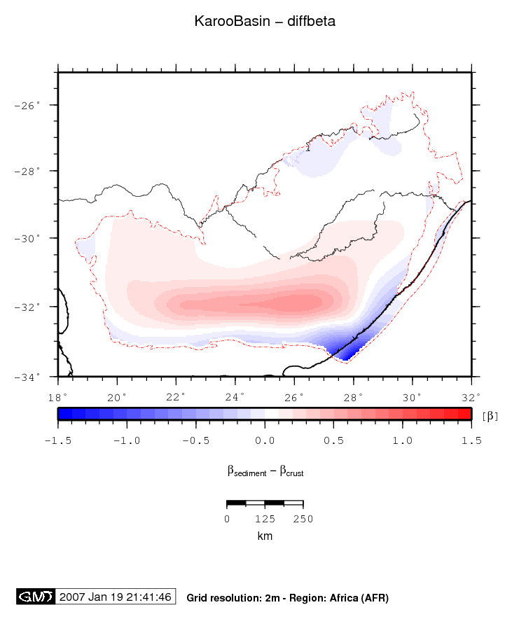
Differential Beta
Karoo Basin location map
Statistics - Differential Beta
Median -0.007
Mean -0.021
Scale 0.127
stdev 0.154
Z_min/Location -1.641/-33.5667°Lat 27.8667°Lon
Z_max/Location 0.405/-33.0°Lat 25.9667°Lon

Comments

For explanation to the data source or computation of this grid please follow this link. Clicking the image will open a high-res PDF of the map. Units in the statistics table are same as map units. Z_min and Z_max refer to the minima and maxima with their respective geographic locations.

↑ back to the top
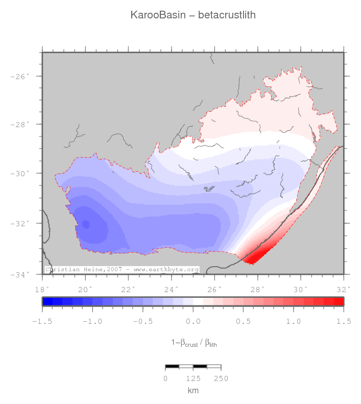
Crustal vs lithosph. extn.
Karoo Basin location map
Statistics - Crustal vs lithosph. extn.
Median -0.162
Mean -0.166
Scale 0.389
stdev 0.339
Z_min/Location -0.822/-32.0°Lat 20.0°Lon
Z_max/Location 2.374/-33.5667°Lat 27.8667°Lon

Comments

For explanation to the data source or computation of this grid please follow this link. Clicking the image will open a high-res PDF of the map. Units in the statistics table are same as map units. Z_min and Z_max refer to the minima and maxima with their respective geographic locations.

↑ back to the top
Anomalous TTS
Karoo Basin location map
Statistics - Anomalous TTS
Median -0.051
Mean -0.204
Scale 1.002
stdev 0.965
Z_min/Location -2.261/-27.5333°Lat 29.4667°Lon
Z_max/Location 1.684/-32.8333°Lat 25.6333°Lon

Comments

For explanation to the data source or computation of this grid please follow this link. Clicking the image will open a high-res PDF of the map. Units in the statistics table are same as map units. Z_min and Z_max refer to the minima and maxima with their respective geographic locations.

↑ back to the top
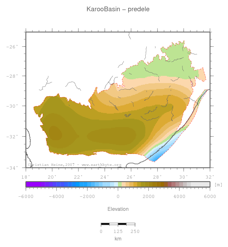
Predicted elevation
Karoo Basin location map
Statistics - Predicted elevation
Median 1188.830
Mean 1035.550
Scale 747.061
stdev 671.739
Z_min/Location -1935.630/-33.5667°Lat 27.8667°Lon
Z_max/Location 2064.940/-31.9°Lat 20.1°Lon

Comments

For explanation to the data source or computation of this grid please follow this link. Clicking the image will open a high-res PDF of the map. Units in the statistics table are same as map units. Z_min and Z_max refer to the minima and maxima with their respective geographic locations.

↑ back to the top

This basin data is based on interpolated global grids and might contain gridding errors or wrongly interpolated data values.


Page generated 2007-09-30 21:53:47 CEST | © Christian Heine, School of Geosciences, Sydney University, Australia